EF0 Tornado at Stayner ON
An NTP investigation has concluded that an EF0 tornado hit an area just SW of Stayner, ON on June 26th. Multiple photos and videos showed a funnel cloud over the area, some with lofted dust/debris near the ground. An NTP ground/drone survey on the 27th found a relatively long, narrow path of damage. Full details are provided in the summary below, along with a map and some photos from the survey.
====
Event Name: Stayner, ON
Date: June 26, 2023
Start Time: 3:20 PM EDT (1920 UTC)
Final Classification: Tornado (over land)
Final EF-Scale Rating: EF0
EF-Scale Damage Indicator / Degree of Damage: FR12/DOD-2
Start of damage track: 44.3857N, 80.1035W
End of damage track: 44.4109N, 80.1026W
Location of Worst Damage: 44.3998N, 80.1009W
Description: Witnesses captured video of a tornado south of Stayner, with roof, tree and fence damage reported in the area. No injuries were reported. An NTP ground and drone survey was completed on June 27, 2023 documenting the reported damage as well as narrow path of visible crop damage. Damage assessed as EF0 tornado, with an estimated max. wind speed of 125 km/h, track length of 2.82 km and max. path width of 120 m. Tornado motion was from the S (approx. 180 degrees). Satellite imagery review is pending. Start time is estimated based on witness reports.
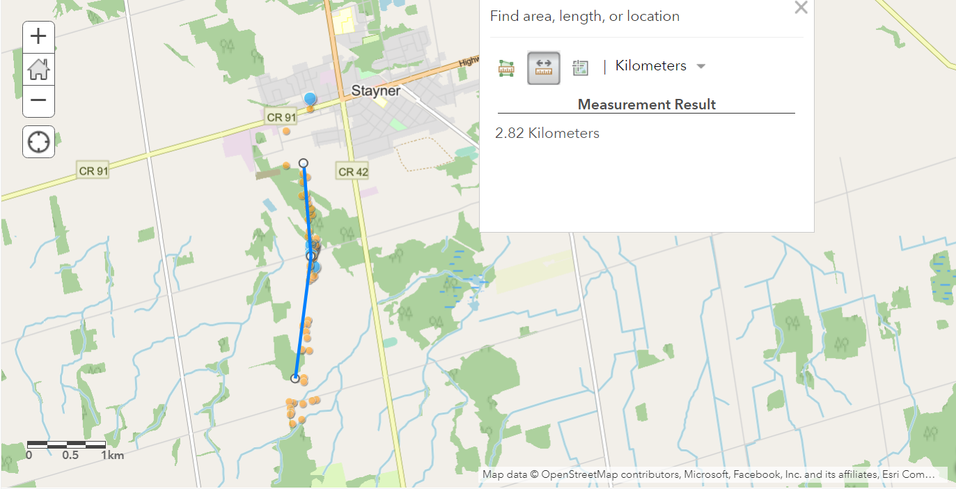
Map showing damage path - ground photos (blue pins), drone photos (orange pins), and tornado path (blue line)
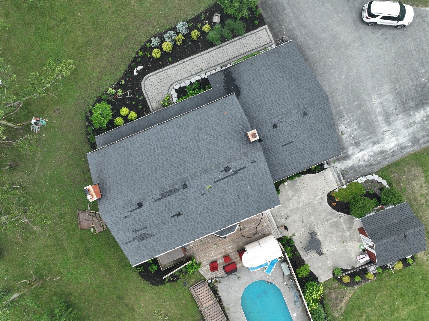
Shingle and tree damage at worst damage point. Shingle damage was already patched at this point.
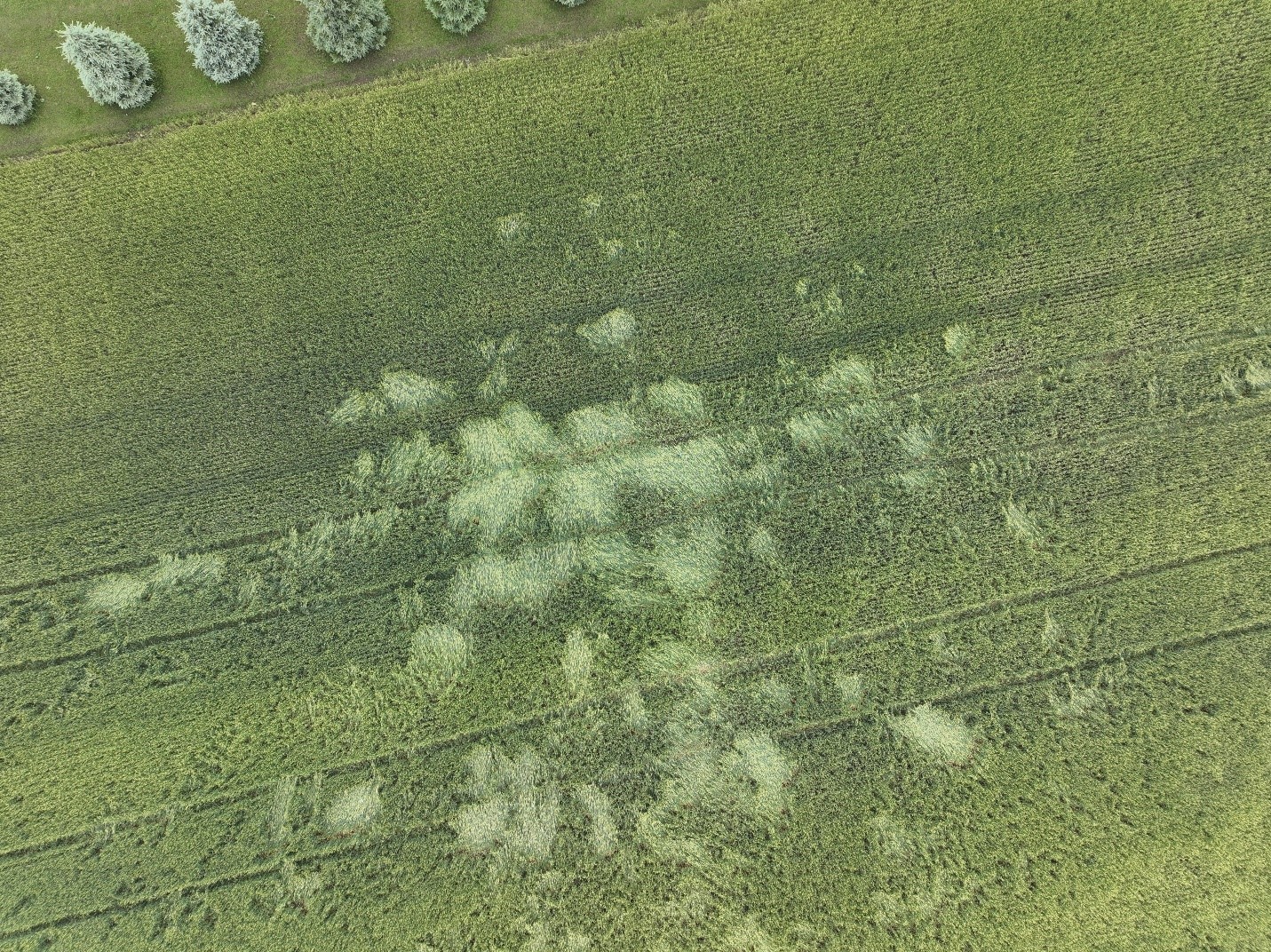
Convergent pattern in crops along tornado damage path.