Downbursts in MB on Aug 24 and Aug 31
NTP investigations have confirmed downbursts in southern MB. Three EF0 downbursts were assessed from storms on August 24 from Winnipeg southeast to Richer. An EF1 downburst was assessed at Morweena from a storm on August 31. Details are provided in the event summaries below, along with a map and images from the damage surveys.
====
Event Name: Winnipeg, MB
Date: August 24, 2023
Time: 6:30 PM CDT (2330 UTC)
Final Classification: Downburst
Final EF-Scale Rating: EF0
EF-Scale Damage Indicator / Degree of Damage: FR12/DOD-2
Location of worst damage: 49.9672N, 97.1884W
Description: Damage to trees, houses (roofing and siding), fences and small sheds was reported in neighbourhoods of northern Winnipeg after a storm passed through. No injuries were reported. An NTP survey team completed ground/drone surveys on August 25 and 29-30, 2023. Satellite imagery review did not reveal any additional visible damage. Damage assessed as EF0 downburst, with an estimated max. wind speed of 125 km/h. Event time is radar estimated.
Event Name: Meadowvale, MB
Date: August 24, 2023
Time: 7:05 PM CDT (0005 UTC)
Final Classification: Downburst
Final EF-Scale Rating: EF0
EF-Scale Damage Indicator / Degree of Damage: C-T/DOD-3
Location of worst damage: 49.8266N, 96.7881W
Description: Tree damage was reported in the Meadowvale area (east of Winnipeg) after a storm passed through. No injuries were reported. An NTP survey team completed ground/drone surveys on August 25 and 29-30, 2023. Satellite imagery review did not reveal any additional visible damage. Damage assessed as EF0 downburst, with an estimated max. wind speed of 115 km/h. A weather station in the vicinity of the damage (Station ID: Dugald, operated by the Province of Manitoba) posted a max. wind gust of 132.7 km/h at the 8 PM CDT observation (occurred between 7-8 PM CDT, value unverified). Event time is radar estimated.
Event Name: Richer, MB
Date: August 24, 2023
Time: 7:40 PM CDT (0040 UTC)
Final Classification: Downburst
Final EF-Scale Rating: EF0
EF-Scale Damage Indicator / Degree of Damage: C-T/DOD-3
Location of worst damage: 49.6784N, 96.4545W
Description: Tree damage was reported in the Richer area after a storm passed through. No injuries were reported. An NTP survey team completed ground/drone surveys on August 25 and 29-30, 2023. Satellite imagery review revealed isolated tree damage. Damage assessed as EF0 downburst, with an estimated max. wind speed of 115 km/h. Event time is radar estimated.
Event Name: Morweena, MB
Date: August 31, 2023
Time: 6:20 PM CDT (2320 UTC)
Final Classification: Downburst (Microburst)
Final EF-Scale Rating: EF1
EF-Scale Damage Indicator / Degree of Damage: SBO/DOD-7
Location of worst damage: 50.9929N, 97.3104W
Description: A barn was heavily damaged after a storm passed through the Morweena area (northwest of Arborg). No injuries were reported. An NTP ground and drone survey was completed on September 6, 2023, documenting the reported damage and tree damage on the property and nearby, with damage found over an area approx. 2.9 km x 0.8 km. Satellite imagery review did not reveal any additional visible damage. Damage assessed as EF1 downburst (microburst), with an estimated max. wind speed of 135 km/h. Event time is based on a witness report.
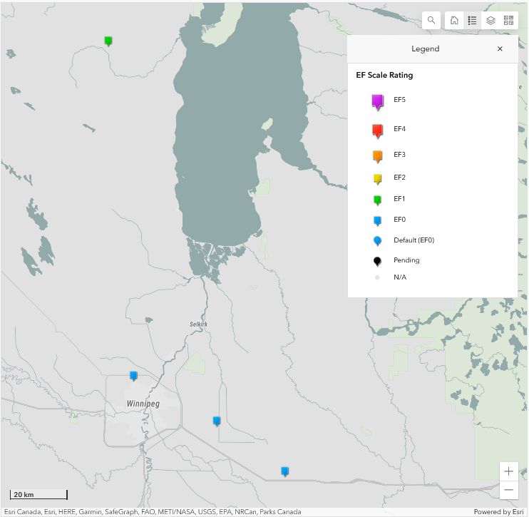
Map showing the location and ratings of the Morweena, Winnipeg, Meadowvale and Richer downbursts in southern Manitoba.
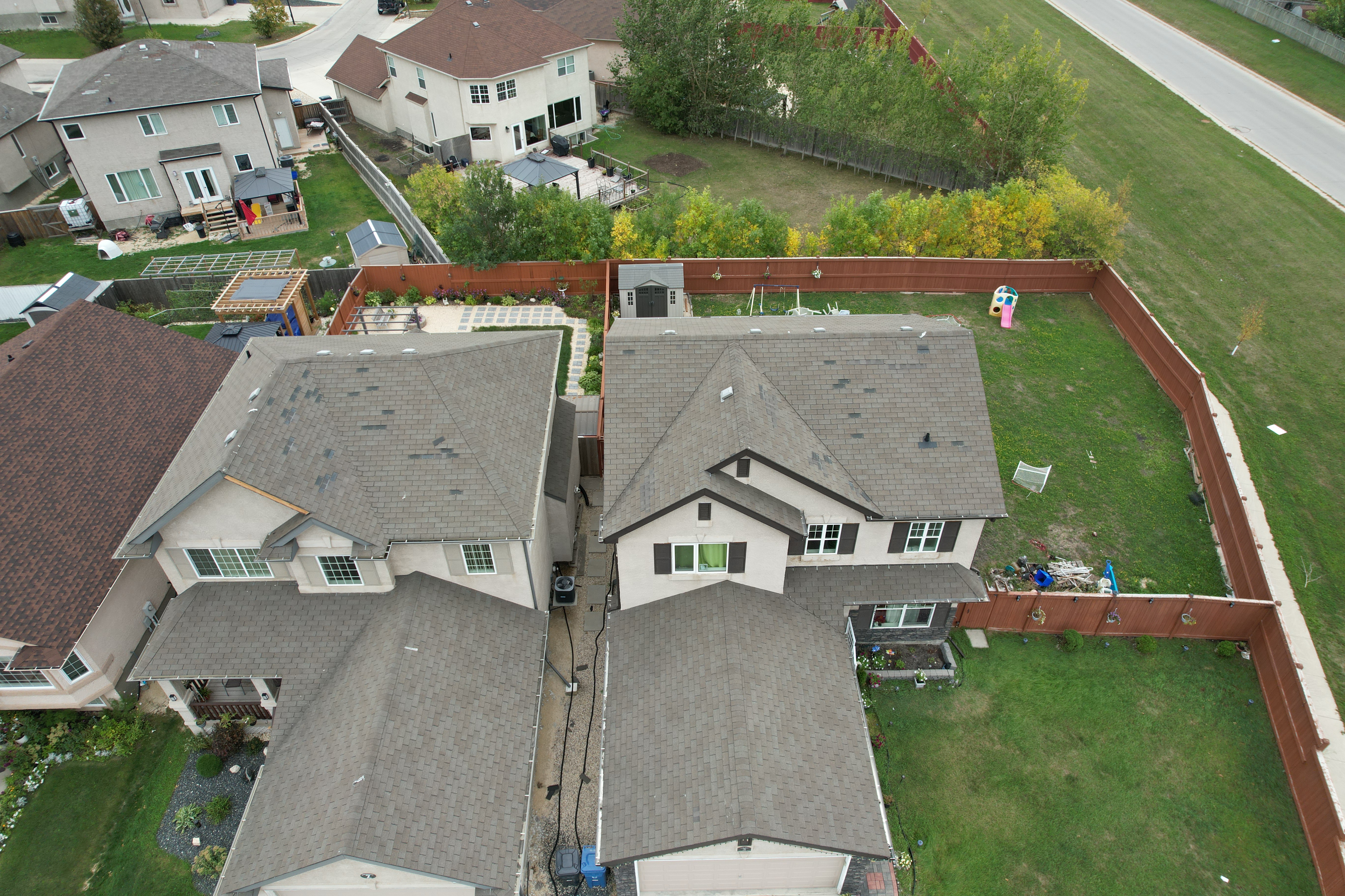
NTP drone photo of multiple houses with shingle damage on the west side of the roof in the Mandalay West neighbourhood of Winnipeg. One house also has some fascia damage.
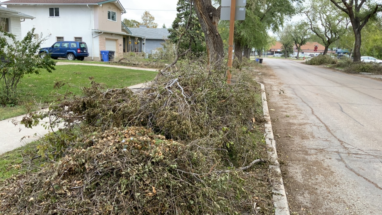
Evidence of numerous branches down in the West Kildonan neighbourhood of Winnipeg.
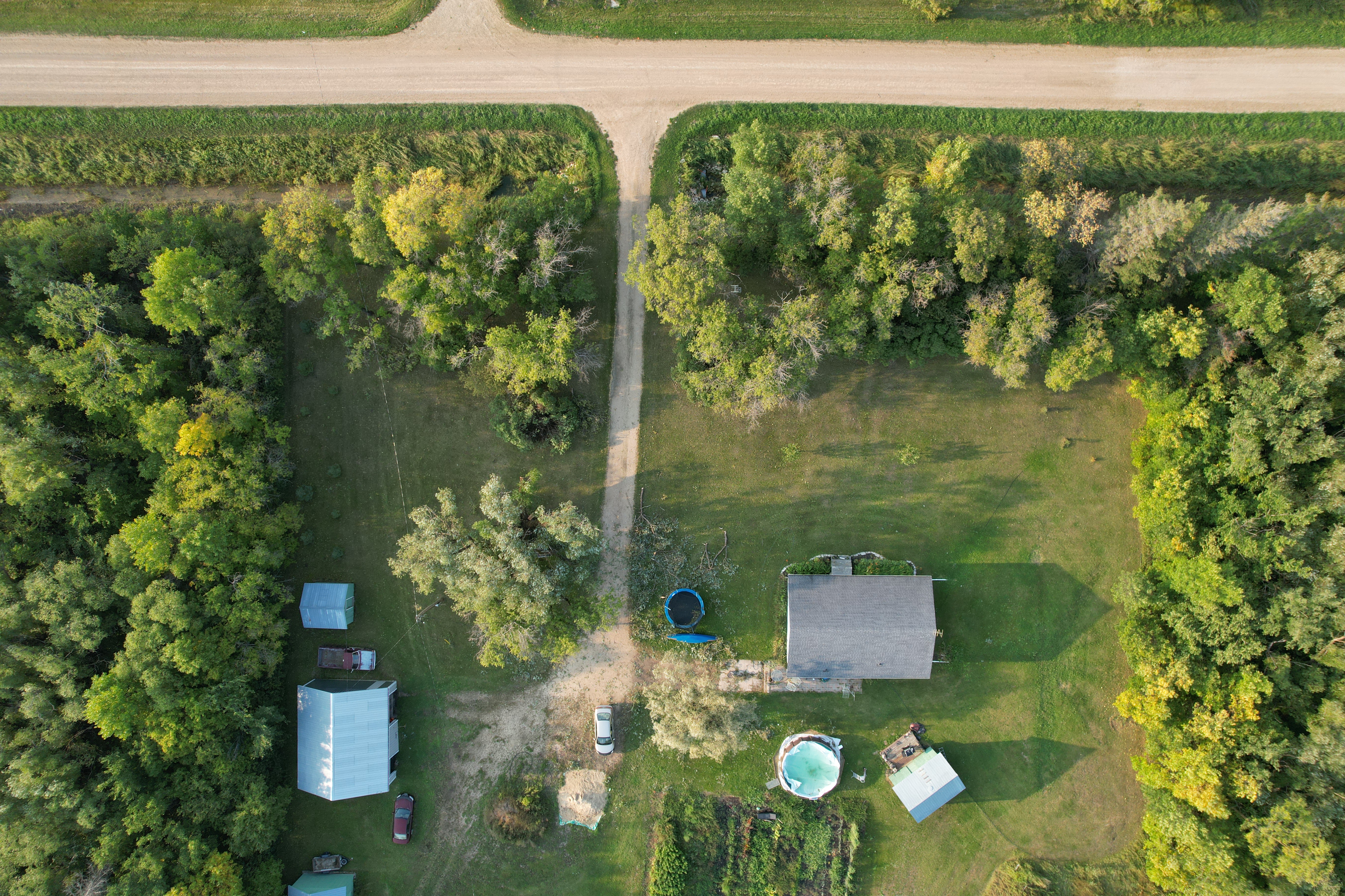
NTP drone photo showing a number of large branches down in the Meadowvale area, SE of Winnipeg.
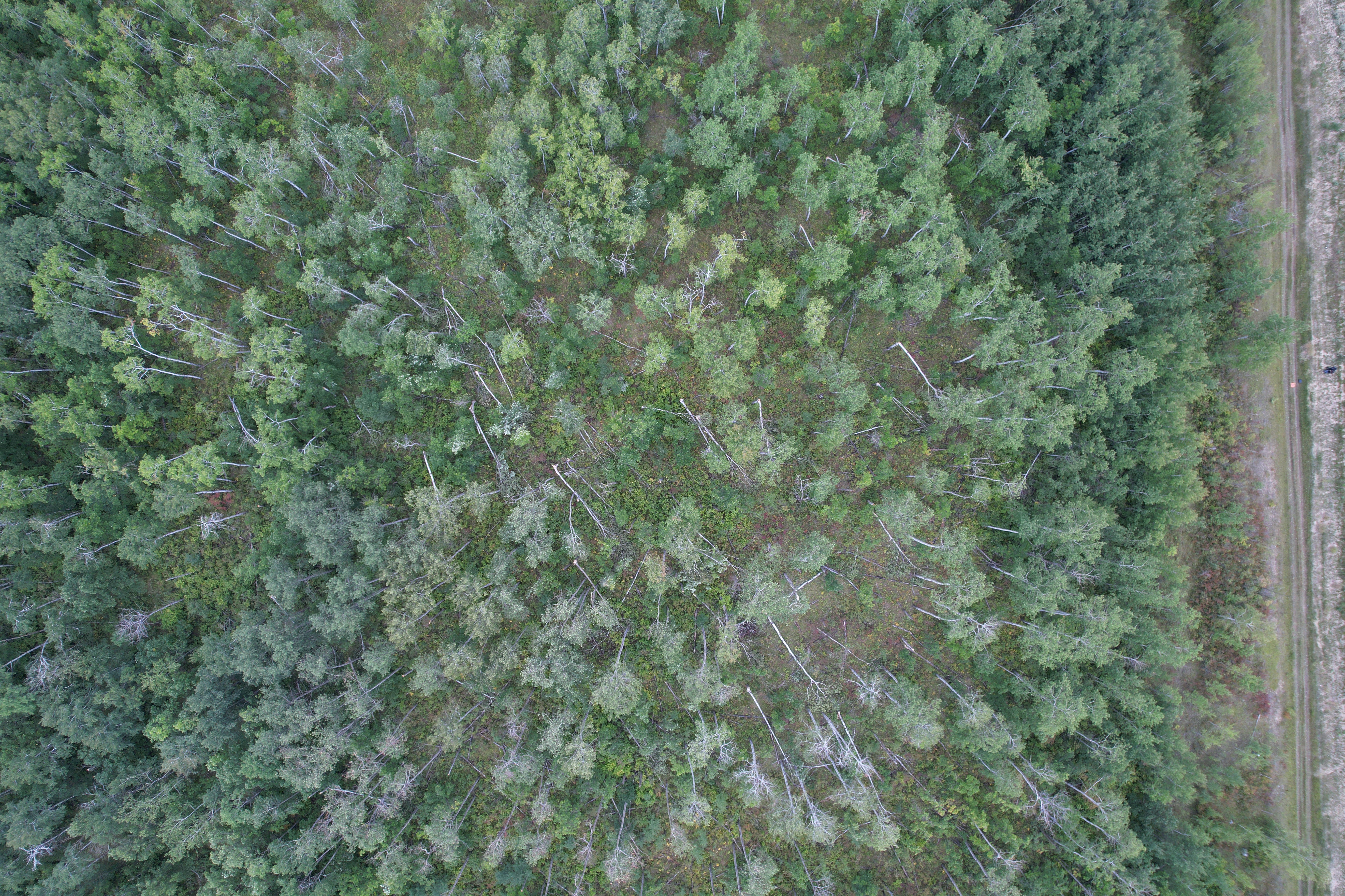
NTP drone photo showing a number of trees snapped by downburst winds to the southeast in the Richer area, southeast of Winnipeg and Meadowvale.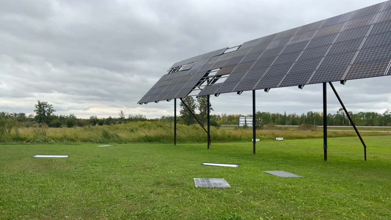
Solar panel damage caused by the downburst winds in the Richer area.
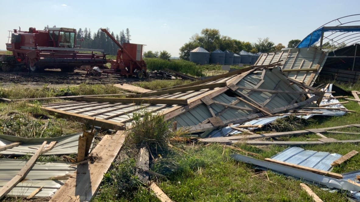
Photo of farm outbuilding destroyed by downburst winds. The outbuilding was originally over the combine, and was anchored by wood beams driven a metre or more into the ground. The large door was open to the wind, however, resulting in a lower bound wind speed here.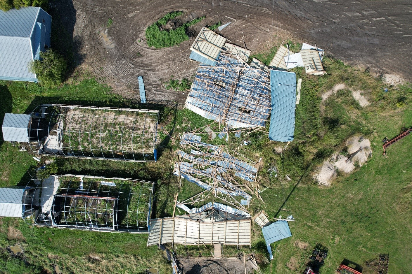
NTP drone image showing farm outbuilding completely flipped over (original location near the bottom of the photo).