Downburst at Chatham ON on Aug 24
An NTP investigation has concluded that an EF0 downburst hit the northeast side of Chatham, Ontario on August 24. Numerous trees were uprooted and snapped, and had large branches broken. There was light roof damage (missing shingles) to several homes. Details are provided in the event summary below, along with a map and survey photos.
====
Event Name: Chatham, ON
Date: August 24, 2023
Estimated Start Time: 11:00 PM EDT (0300 UTC)
Final Classification: Downburst
Final EF-Scale Rating: EF0
Worst Damage Location: 42.4127N, 82.1844W
Description: Photos of damage received over social media. A ground survey found scattered damage over a wide path, including light roof damage and numerous trees damaged. Damage assessed as EF0 downburst, with an estimated max. wind speed of 125 km/h, and a max. width of 2500 m. Orientation of damage swath was from NW to SE (from approx. 315 degrees). Satellite imagery review is pending. Start time is an estimate based on radar.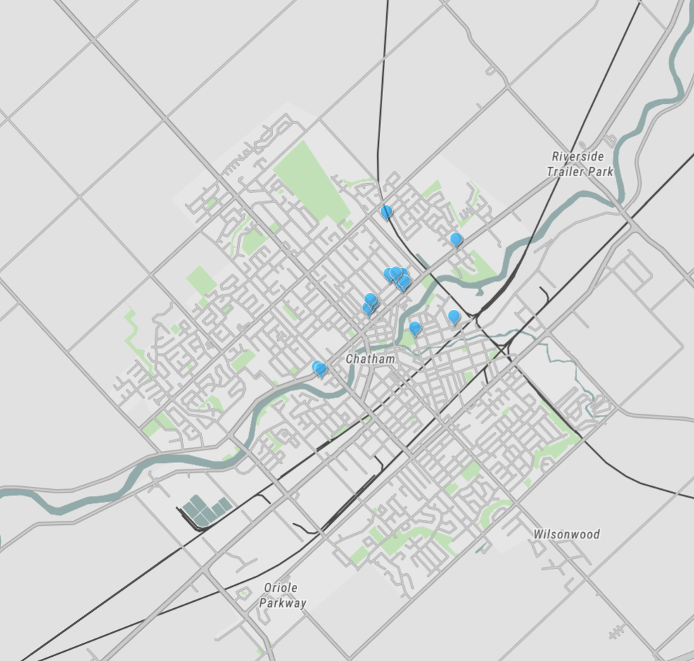
Map of damage points documented from the ground within a wide swath of EF0 damage identified in the northeastern part of Chatham. Note that these and other areas of damage were documented via drone flights.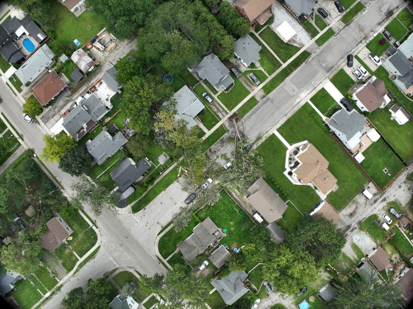
Drone image of unidirectional tree damage identified around Selkirk St and Van Allen Ave.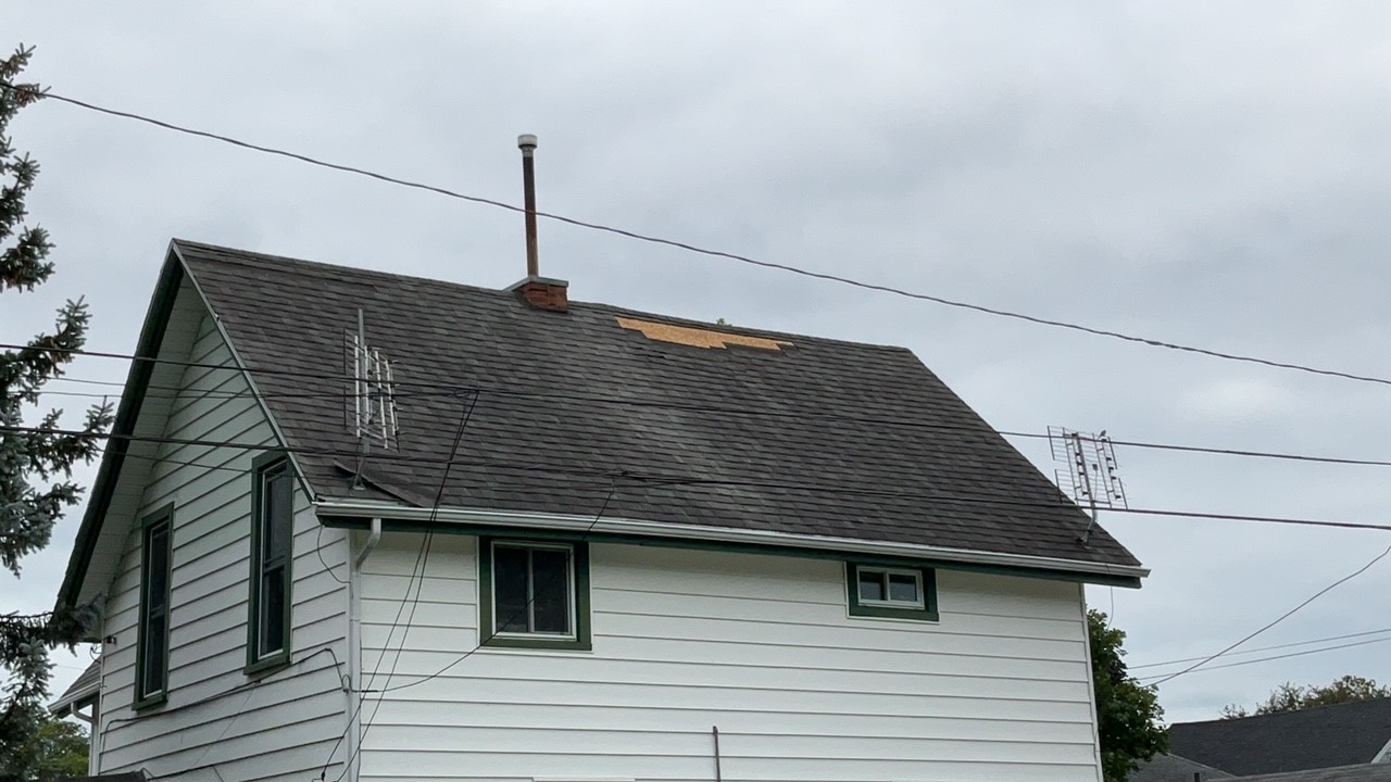
Damage rated FR12/DOD-2, 125 km/h, EF0 at 76 Van Allen Ave.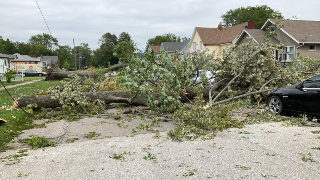
Uprooted and snapped trees affecting power lines near 242 Selkirk St.