A tornado and microburst in QC from July 18
NTP investigation has led to the confirmation of an EF1 tornado and an EF0 microburst in southern Quebec from the storms there on July 18. An NTP ground/drone survey was conducted on July 20th and found evidence for a tornado at Brompton, near Sherbrooke, and a microburst at Saint-Alphonse-de-Granby near Granby. In both cases, the worst damage was to farm buildings of various construction. Details are provided in the summaries below. Maps and photos are also provided.
Event information can also be viewed and plotted via the NTP Dashboard at https://uwo.ca/ntp/dashboard.
====
Event Name: Saint-Alphonse-de-Granby, QC
Date: July 18, 2023
Start Time: 3:05 PM EDT (1905 UTC)
Final Classification: Downburst (Microburst)
Final EF-Scale Rating: EF0
EF-Scale Damage Indicator / Degree of Damage: SBO/DOD-6
Location of worst damage: 45.3122N, 72.8102W
Description: Barn, tree and crop damage was reported in the Saint-Alphonse-de-Granby area after a storm passed through. No injuries were reported. An NTP ground and drone survey was completed on July 20, 2023, documenting the reported damage. Damage assessed as EF0 downburst (microburst), with an estimated max. wind speed of 130 km/h. Satellite imagery review is pending. Event time is radar estimated.
Event Name: Brompton, QC
Date: July 18, 2023
Start Time: 4:30 PM EDT (2030 UTC)
Final Classification: Tornado (over land)
Final EF-Scale Rating: EF1
EF-Scale Damage Indicator / Degree of Damage: SBO/DOD-6
Start of damage track: 45.4660N, 71.9888W
End of damage track: 45.4840N, 71.9457W
Location of worst damage: 45.4711N, 71.9764W
Description: Barn, tree and crop damage was reported in the Brompton area (north of Sherbrooke) after a storm passed through. No injuries were reported. An NTP ground and drone survey was completed on July 20, 2023, documenting the reported damage along with minor damage to a home and power pole. Damage assessed as EF1 tornado, with an estimated max. wind speed of 155 km/h, track length of 3.93 km and max. path width of 370 m. Tornado motion was from the SW (approx. 215 degrees). Satellite imagery review is pending. Start time is radar estimated.
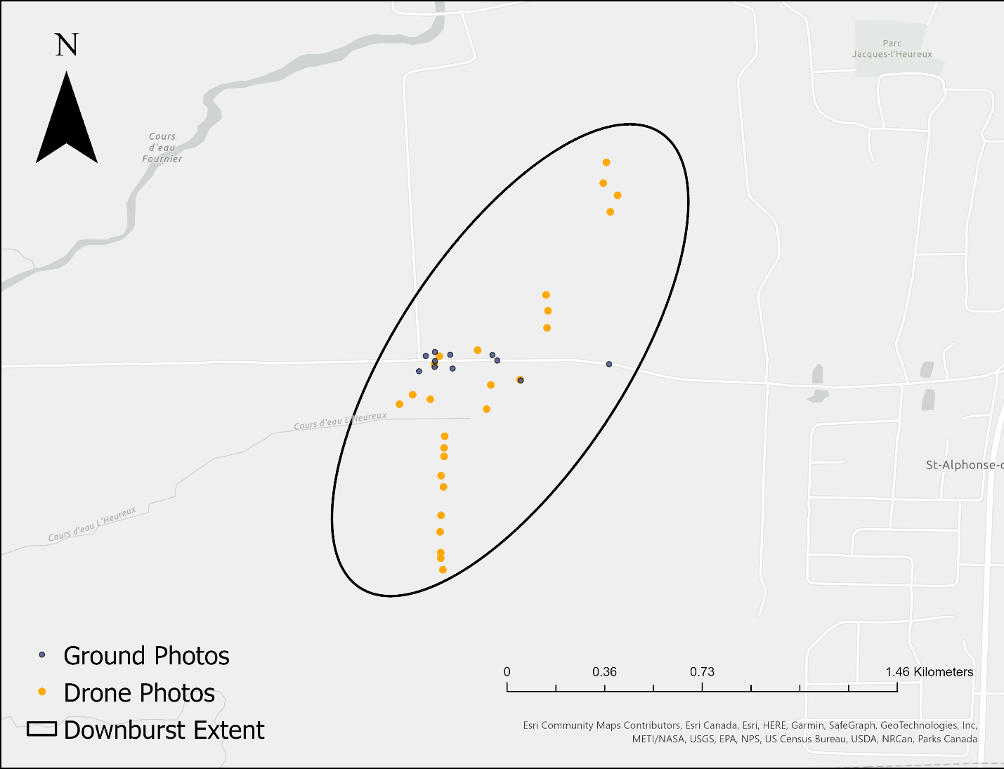
Map showing extent of worst downburst damage and survey points (ground & drone)
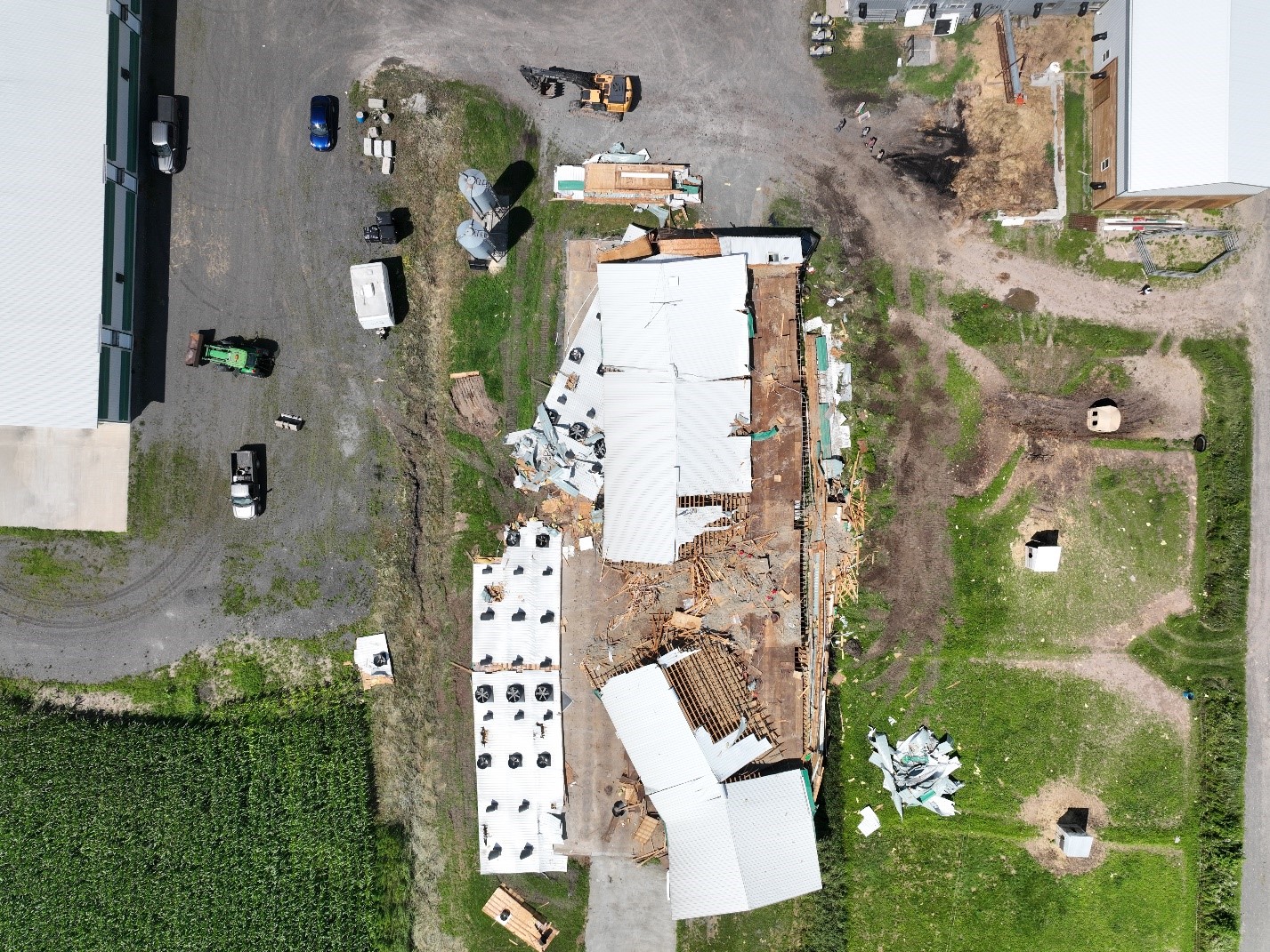
Drone photo showing extent of damage to barn. Note: the west wall has a significant number of fans and vents, which likely led to high internal pressures inside the barn before failure due to the E / NE winds.
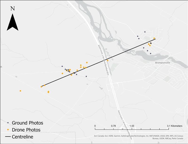
Map displaying track of the tornado and survey points (ground & drone), along with the centerline of the tornado.
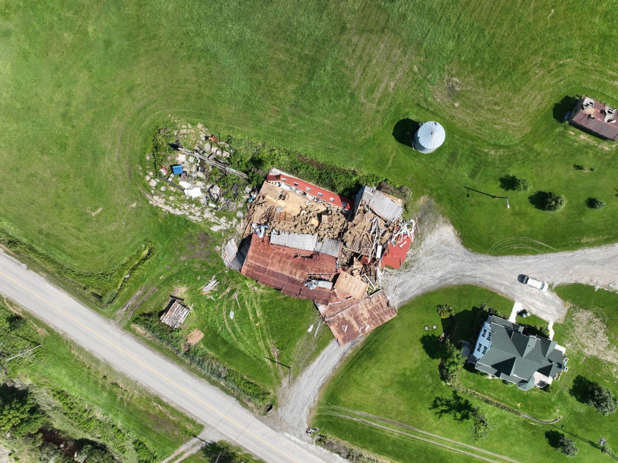
Drone imagery showing SBO DOD-6 damage: barn walls collapsed.
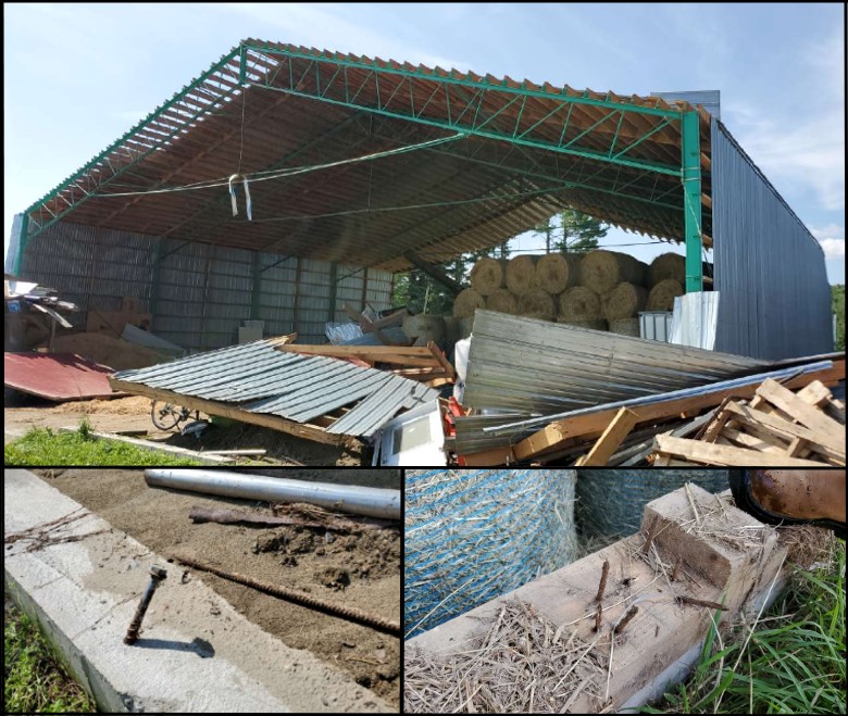
Ground photos of a different barn that sustained wall collapse, along with photos that highlight the appropriate connections for the wall studs to floor plate, and anchor bolts for the sill plate to foundation connection.