Late Additions to 2022 Tornado Count
Systematic satellite imagery analysis that NTP performs at the end of each season has turned up an additional three tornadoes from the 2022 season: two tornadoes (EF2 and EF1) in northern Ontario on May 31st (outside radar range) and one EF2 tornado in southwestern Manitoba on June 29th. In each case, tree damage was visible in high-resolution satellite imagery. Details are provided in the summaries and images below.
====
Event Name: Attawapiskat Lake, ON
Date: May 31, 2022
Start Time: 4:00 PM EDT (2000 UTC)
Final Classification: Tornado (Over Land)
Final EF-Scale Rating: EF2
EF-Scale Damage Indicator / Degree of Damage: C-T/DOD-6
Start of damage track: 52.1658N, 87.6997W
End of damage of track: 52.2975N, 87.6211W
Location of worst damage: 52.2186N, 87.685W
Description: Satellite imagery review revealed a tornado damage path in forested areas east of Lansdowne House. Tornado damage assessed as EF2, with an estimated max. wind speed of 190 km/h, track length of 16.2 km and max. path width of 780 m. Tornado motion was from the SSW (approx. 200 degrees). Start time is estimated based on GOES visible satellite imagery.
Event Name: Becker Lake, ON
Date: May 31, 2022
Start Time: 5:10 PM EDT (2110 UTC)
Final Classification: Tornado (Over Land)
Final EF-Scale Rating: EF1
EF-Scale Damage Indicator / Degree of Damage: C-T/DOD-5
Start of damage track: 52.7400N, 87.4856W
End of damage of track: 52.7900N, 87.4783W
Location of worst damage: 52.7564N, 87.4842W
Description: Satellite imagery review revealed a tornado damage path in forested areas south of Webequie. Tornado damage assessed as EF1, with an estimated max. wind speed of 170 km/h, track length of 5.31 km and max. path width of 300 m. Tornado motion was from the S (approx. 185 degrees). Start time is estimated based on GOES visible satellite imagery.
Event Name: Cabin Lake (Kenville), MB
Date: June 29, 2022
Start Time: 7:57 PM CDT (0057 UTC)
Final Classification: Tornado (Over Land)
Final EF-Scale Rating: EF2
EF-Scale Damage Indicator / Degree of Damage: C-T/DOD-6
Start of damage track: 51.8914N, 101.1183W
End of damage of track: 51.8822N, 100.8111W
Location of worst damage: 51.8694N, 100.9272W
Description: Satellite imagery review revealed a tornado damage path through forested areas near Duck Mountain Provincial Park, southeast of Kenville. Damage assessed as EF2, with an estimated max. wind speed of 190 km/h, track length of 21.8 km and max. path width of 1.55 km. Tornado motion was from the W (approx. 275 degrees). Start time is radar estimated.
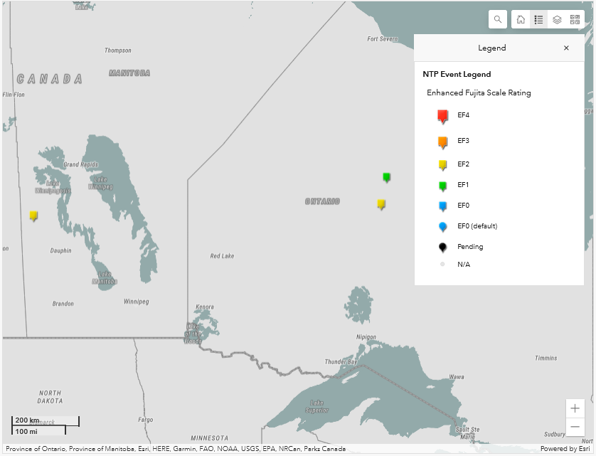
Map showing the start locations of the EF2 tornado in Manitoba and the EF2 and EF1 tornadoes in Ontario.
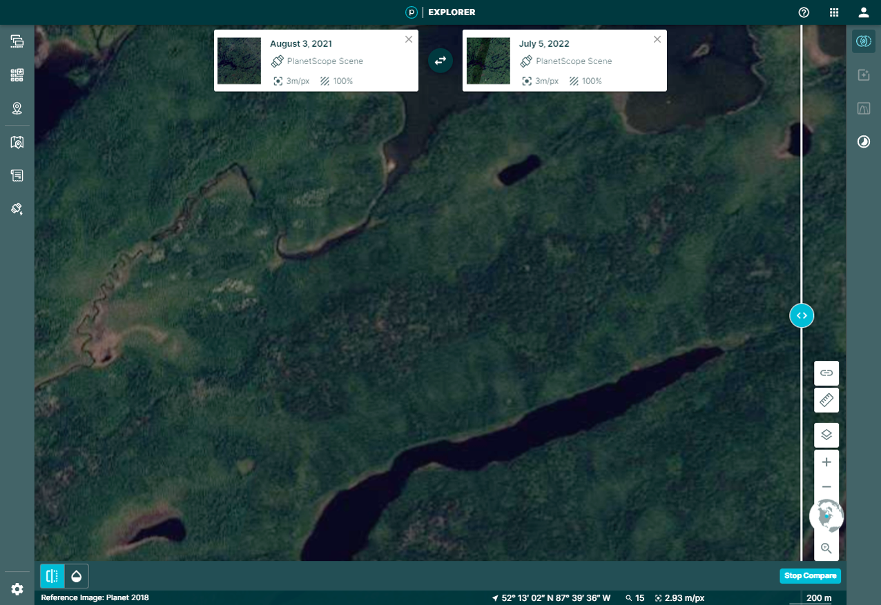
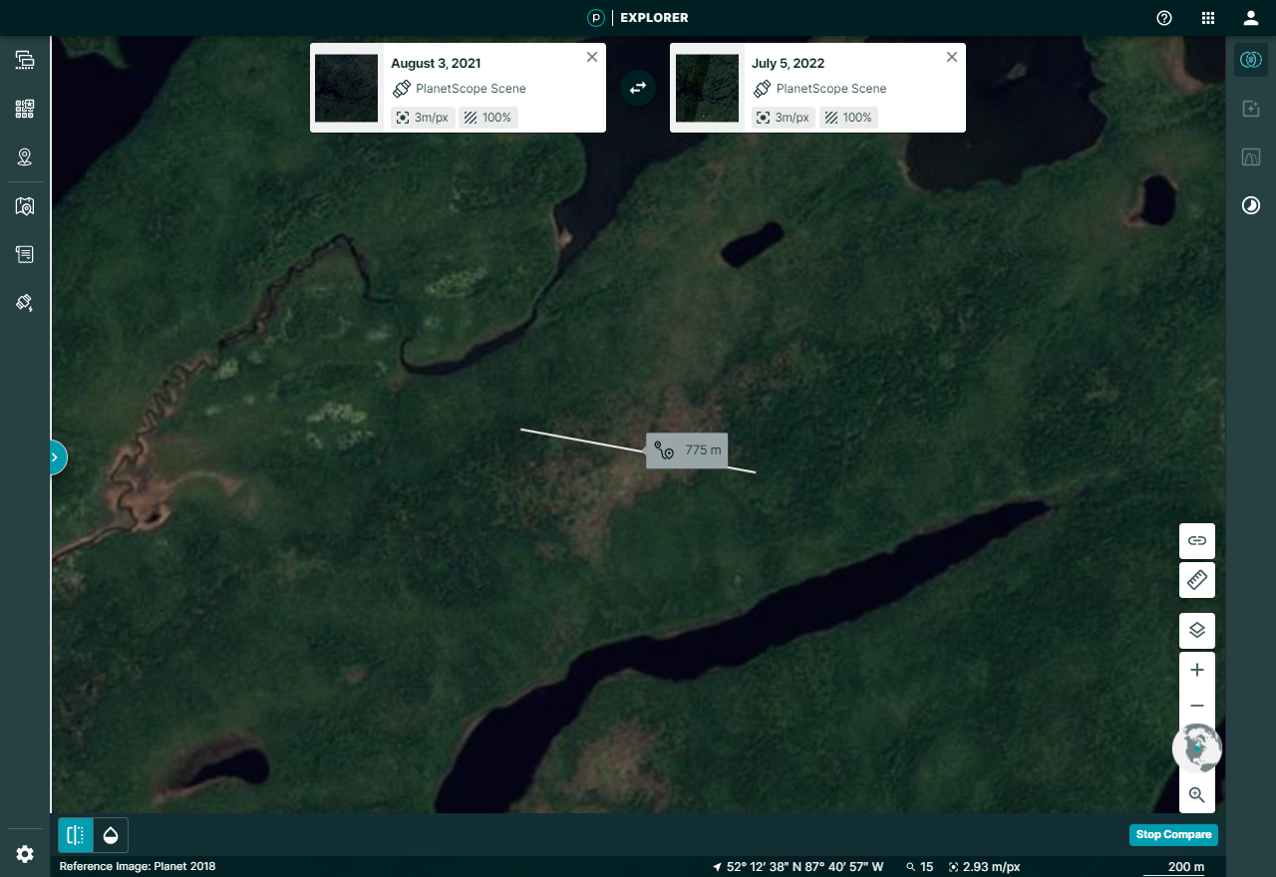
Planet 3-m satellite imagery 'before' and 'after' the date of the Attawpiskat, ON EF2 tornado. Only part of the tornado path is shown so details can be seen. The tornado damage path width is superimposed on the 'after' image.
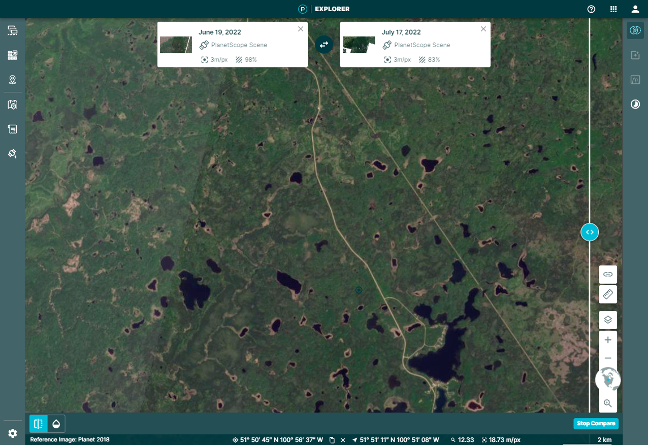
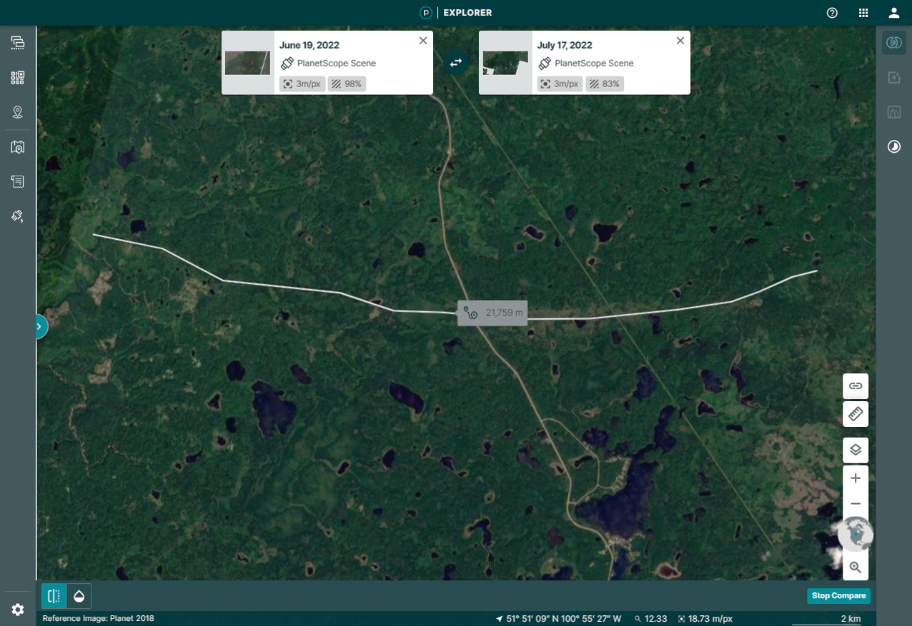
Planet 3-m satellite imagery 'before' and 'after' the date of the Cabin Lake, MB EF2 tornado. The tornado damage path length is superimposed on the 'after' image.