Strong downburst in NT
NTP's last outstanding event for 2021 - and it's an unusual one. An EF2 downburst in the Northwest Territories!
The storm that produced this downburst was part of a series of storms along the northern edge of the 'heat dome' that affected much of British Columbia and neighbouring areas.
Details for the event are provided below.
- Event Name: Sambaa K'e, NT
- Date: June 29, 2021
- Time: 10:45 PM MDT (0445Z)
- Final Classification: Downburst
- Final EF-Scale Rating: EF2
- EF-Scale Damage Indicator / Degree of Damage: C-T/DOD-6
- Damage Area: 60.3469N, 121.7686W
- Description: A significant downburst event caused widespread tree damage east of Fort Liard, from Celibeta Lake to Sambaa K'e (Trout Lake). Satellite imagery review revealed continuous visible tree damage for more than 60 km and up to 9 km wide. While a single downburst event is recorded for this event, it is likely that analysis of treefall patterns seen with higher-resolution imagery would reveal a series of overlapping downburst events along the damage swath. Damage assessed as EF2 downburst, with an estimated max. wind speed of 190 km/h. Photos taken from aircraft operated by Environment and Natural Resources (GNWT) also show some evidence of defoliation from hail in areas where most trees are snapped/uprooted. Estimated event time based on lightning strike activity.
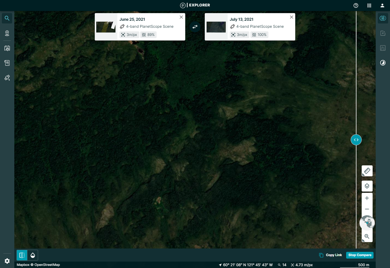
Satellite image before the event.
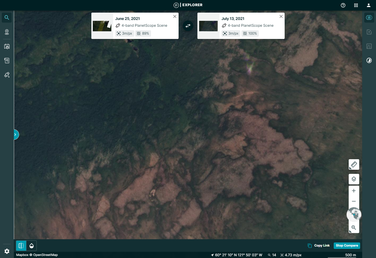
Satellite image after the event.
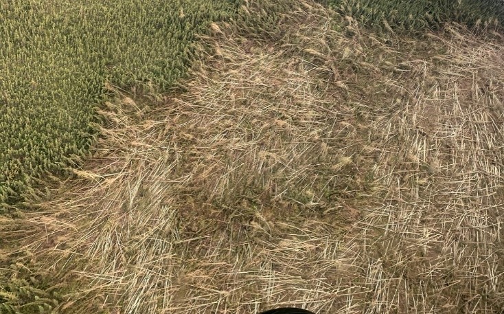
Zoomed aerial image of the swath of uprooted trees, courtesy Environment and Natural Resources (GNWT).