Ontario Tornado Update #3 - Aug 20
NTP investigation has led to the confirmation of two tornadoes in northeastern ON near the QC border in association with a quasi-linear convective system on 20 Aug 2022. Aircraft aerial imagery was required to ensure the damage discovered on satellite imagery was the result EF1 and EF2 tornadoes. Details are provided in the event summaries below.
====
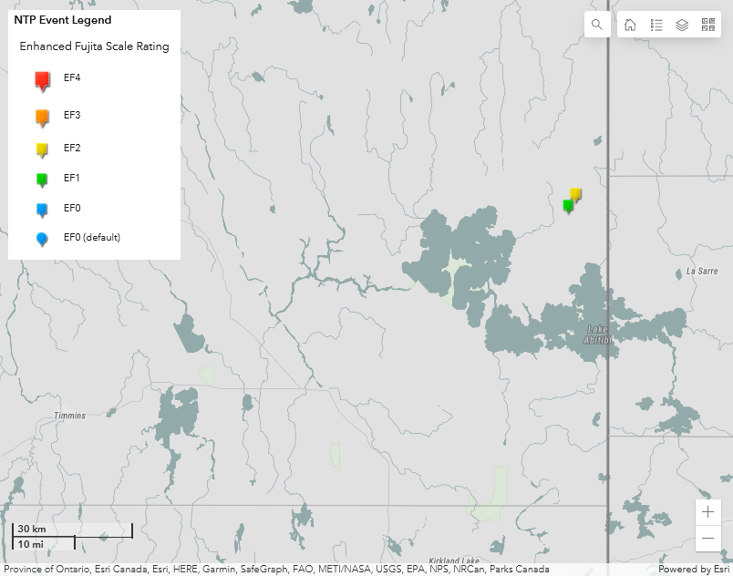
Event Name: Gooseberry Lake (1), ON
Date: August 20, 2022
Start Time: 1:36 PM EDT (1736 UTC)
Final Classification: Tornado (Over Land)
Final EF-Scale Rating: EF1
EF-Scale Damage Indicator / Degree of Damage: C-T/DOD-5
Start of damage track: 48.9213N, 79.6527W
End of damage of track: 48.9241N, 79.6280W
Location of worst damage: 48.9211N, 79.6428W
Description: Satellite imagery review of a storm track of interest revealed visible tree damage near Gooseberry Lake, north of Lake Abitibi and just west of the Ontario-Quebec border. The cause of the damage was unclear and event could not be classified based on satellite imagery alone. Aerial imagery was collected during an aircraft survey on November 10, 2022, and review of that imagery confirmed damage from two tornadoes and a downburst. Damage from the southern tornado (Gooseberry Lake (1)) was assessed as EF1, with an estimated max. wind speed of 170 km/h, track length of 1.92 km and max. path width of 260 m. Tornado motion was from the W (approx. 260 degrees). Start time is radar estimated. Damage from the northern tornado was assessed as EF2 and concurrent downburst damage was preliminarily assessed as EF1.
Event Name: Gooseberry Lake (2), ON
Date: August 20, 2022
Start Time: 1:48 PM EDT (1748 UTC)
Final Classification: Tornado (Over Land)
Final EF-Scale Rating: EF2
EF-Scale Damage Indicator / Degree of Damage: C-T/DOD-6
Start of damage track: 48.9541N, 79.6283W
End of damage of track: 48.9328, 79.5557W
Location of worst damage: 48.9382N, 79.5857W
Description: Satellite imagery review of a storm track of interest revealed visible tree damage near Gooseberry Lake, north of Lake Abitibi and just west of the Ontario-Quebec border. The cause of the damage was unclear and event could not be classified based on satellite imagery alone. Aerial imagery was collected during an aircraft survey on November 10, 2022, and review of that imagery confirmed damage from two tornadoes and a downburst. Damage from the northern tornado (Gooseberry Lake (2)) was assessed as EF2, with an estimated max. wind speed of 190 km/h, track length of 6.09 km and max. path width of 420 m. Tornado motion was from the WNW (approx. 295 degrees). Start time is radar estimated. Damage from the southern tornado was assessed as EF1 and concurrent downburst damage was preliminarily assessed as EF1.