NTP damage survey results from July 24th tornado in eastern ON
Three NTP ground/drone survey teams were sent to the Madoc, ON area on July 25th after extensive wind damage and a tornado were reported there they evening before. The teams spend several days collecting ground and drone observations, then more time analyzing the complex data, in concert with public reports, hi-res satellite data, and aerial aircraft imagery from a project partner (thanks Travis and Mike!). Survey observations were also made by Environment Canada teams and released shortly after the event as initial preliminary results.
The NTP event summary is provided below, along with a map, photos and radar imagery.
Event Name: Rockdale-Actinolite, ON
Date: July 24, 2022
Start Time: 8:00 PM EDT (July 25 0000 UTC)
Final Classification: Tornado (Over Land)
Final EF-Scale Rating: EF2
EF-Scale Damage Indicator / Degree of Damage: C-T / DOD-6
Start of damage track: 44.503 N, 77.828 W
End of damage of track: 44.571 N, 77.136 W
Location of worst damage: 44.547 N, 77.315 W
Description: Witnesses captured video and photos of a multi-vortex supercell tornado that developed at Rockdale and tracked ENE. Extensive tree damage and widespread structural damage were reported along much of the damage path. Outbuildings were damaged and destroyed, and many houses had roof damage. An occupied trailer was flipped and an occupied pickup truck was lofted and thrown approx. 25 m. Multiple injuries were reported. Environment Canada conducted an initial damage survey, while NTP conducted a thorough ground/drone survey starting in the evening on July 25, 2022. Tornado damage was assessed at EF2 with max. wind speed of 190 km/h (>80% trees down), track length of 55.8 km, max. width of 1420 m. Satellite and drone imagery as well as aircraft survey photos from a project partner were used for the start and end points. The motion of the tornado was from the WSW (approx. 250 degrees). Start time is radar estimated. Radar showed a tornado debris signature from 8:11 PM to 8:59 PM. Additional damage will be investigated further and may be due to associated downbursts.
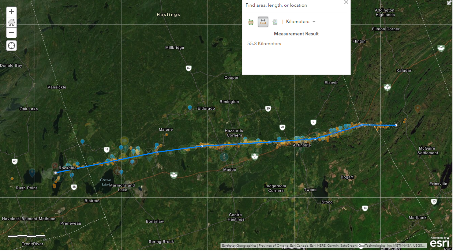
Map showing the 55.8 km long tornado track. Data points used to estimate the track position are underlaid.
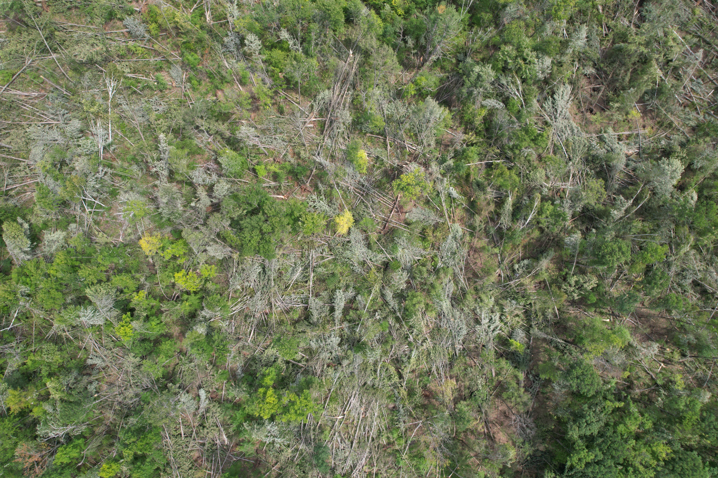
Drone image showing tornadic circulation in tree damage at Rockland near the beginning of the tornado track.
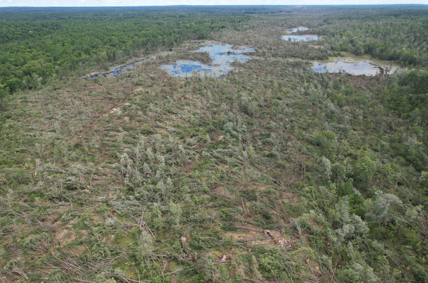
Drone image showing the path of extensive EF2 tree damage east of Actinolite.
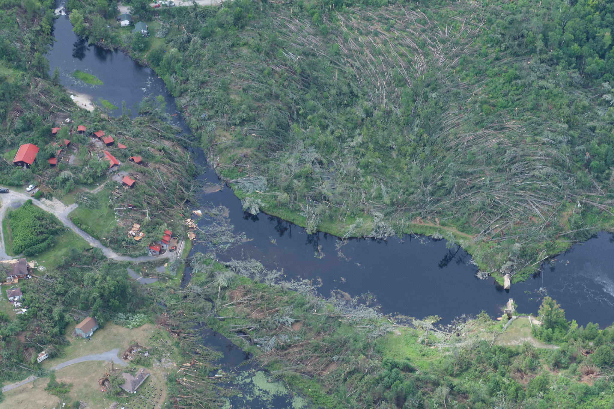
Aircraft aerial image showing the devastating damage at the Bridgewater Retreat near Actinolite.
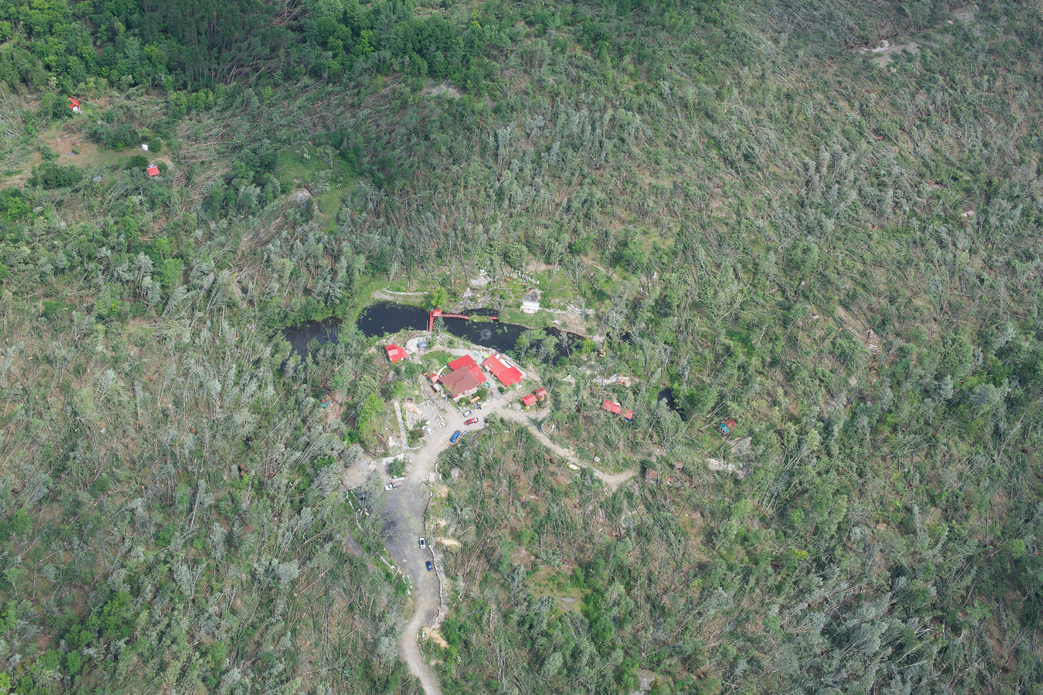
Aircraft aerial image showing the devastating damage at the Huong Hai Zen Forest near Actinolite.
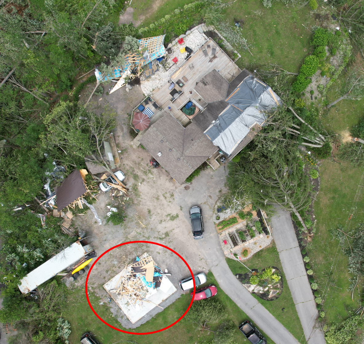
Drone image showing EF2 damage to a well-constructed outbuilding - the foundation was swept of debris, and the debris was placed back there later.
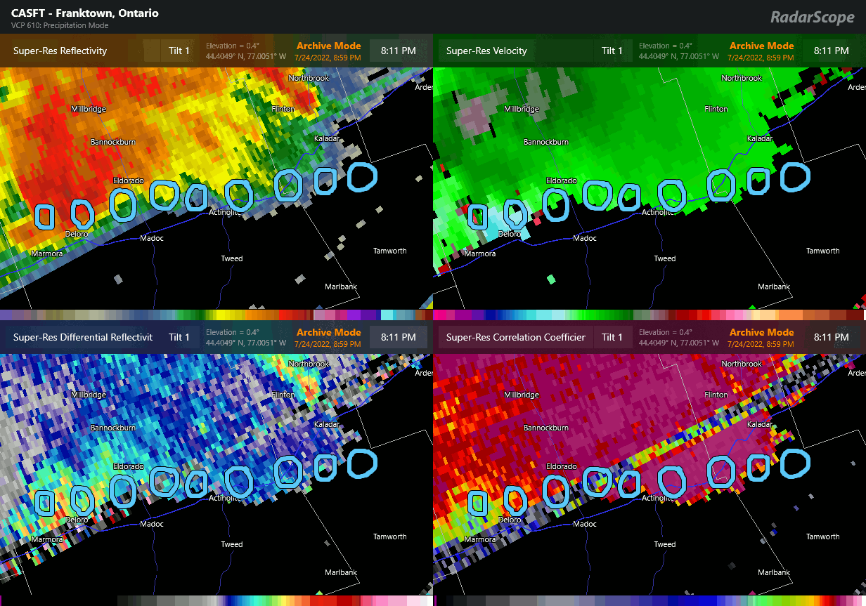
Animation of products from the CASFT (Franktown) radar, with the locations of the tornado debris signature over time circled (every 6 minutes).
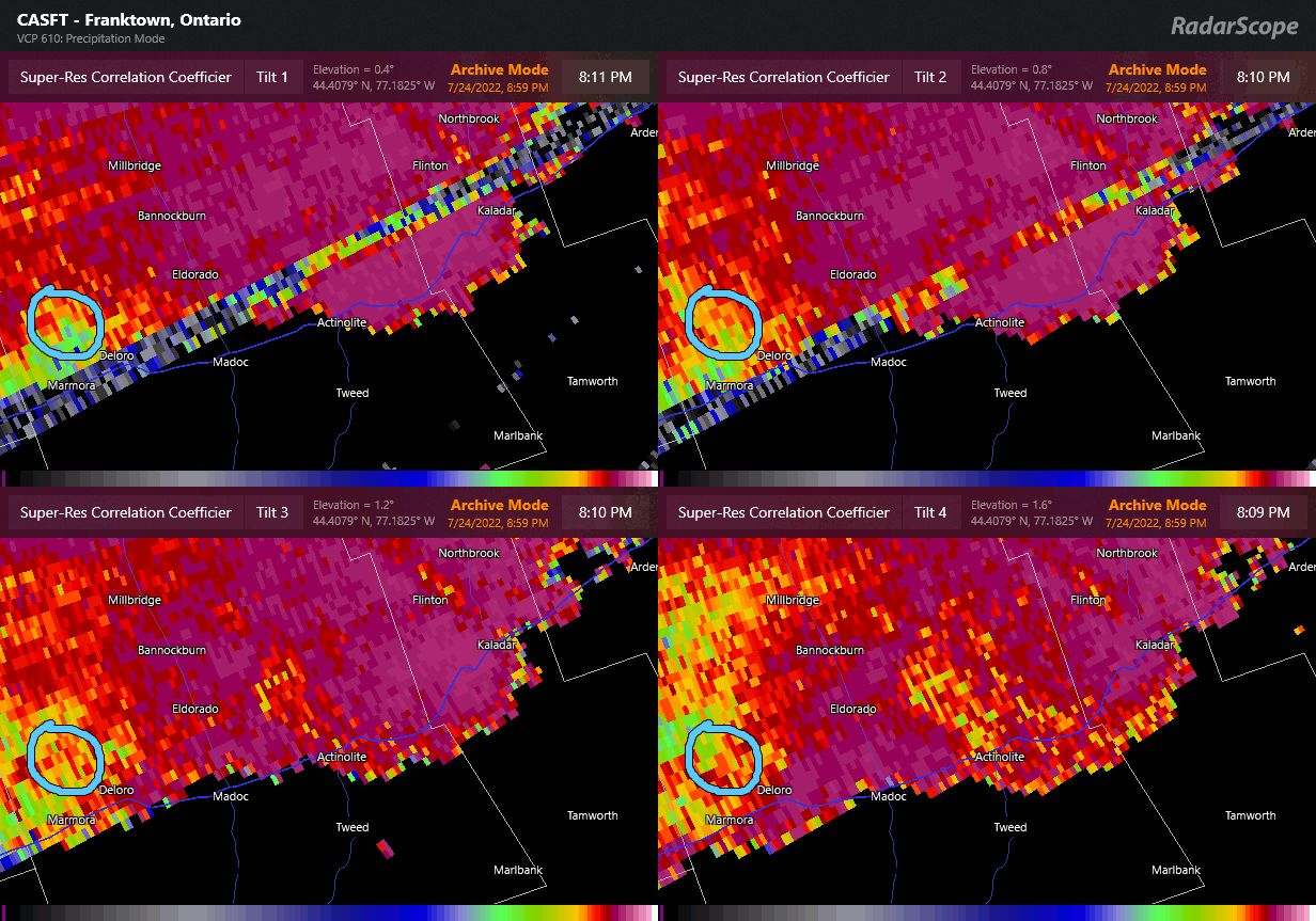
Animation of the cross-correlation product at the four lowest tilts from the CASFT (Franktown) radar, with the location of the tornado debris signature over time circled (every 6 minutes). As debris is lofted, it shows up first on the lowest tilt (Tilt 1) and gradually rises until being picked up on Tilt 4 and spreading out horizontally as it does.