New ON tornadoes: September 20
Careful and thorough NTP investigation has resulted in the confirmation of 3 new tornadoes in NW ON on September 20. This brings the total number of tornadoes with this event to 4. The new events include one EF2 tornado and two EF1 tornadoes. The summaries below provide more details.
The tornadoes occurred beyond radar range, but the environment was one that supported supercell thunderstorms (see image below) and a supercell was present earlier and moved beyond radar range (see image below).
====
Event Name: Dusey Lake, ON
Date: September 20, 2022
Start Time: 8:30 PM EDT (0030 UTC)
Final Classification: Tornado (Over Land)
Final EF-Scale Rating: EF2
EF-Scale Damage Indicator / Degree of Damage: C-T/DOD-6
Start of damage track: 51.1239N, 86.8478W
End of damage of track: 51.1322N, 86.8078W
Location of worst damage: 51.1328N, 86.8219W
Description: Satellite imagery review of a storm track of interest revealed a tornado damage path through forested areas southwest of Ogoki. Damage assessed as EF2 tornado, with an estimated max. wind speed of 190 km/h, track length of 3.14 km and max. path width of 380 m. Tornado motion was from the WSW (approx. 250 degrees). Start time is estimated based on archived lightning data.
Event Name: Winslow Lake, ON
Date: September 20, 2022
Start Time: 8:45 PM EDT (0045 UTC)
Final Classification: Tornado (Over Land)
Final EF-Scale Rating: EF1
EF-Scale Damage Indicator / Degree of Damage: C-T/DOD-5
Start of damage track: 51.1244N, 86.6650W
End of damage of track: 51.1242N, 86.4953W
Location of worst damage: 51.1191N, 86.6136W
Description: Satellite imagery review of a storm track of interest revealed a tornado damage path through forested areas southwest of Ogoki. Damage assessed as EF1 tornado, with an estimated max. wind speed of 145 km/h, track length of 12.4 km and max. path width of 590 m. Tornado motion was from the W (approx. 270 degrees). Start time is estimated based on archived lightning data.
Event Name: Calladine Lake, ON
Date: September 20, 2022
Start Time: 9:30 PM EDT (0130 UTC)
Final Classification: Tornado (Over Land)
Final EF-Scale Rating: EF1
EF-Scale Damage Indicator / Degree of Damage: C-T/DOD-5
Start of damage track: 51.0772N, 86.2394W
End of damage of track: 51.0728N, 86.0744W
Location of worst damage: 51.0767N, 86.1406W
Description: Satellite imagery review of a storm track of interest revealed a tornado damage path through forested areas south of Ogoki. Damage assessed as EF1 tornado, with an estimated max. wind speed of 170 km/h, track length of 11.7 km and max. path width of 430 m. Tornado motion was from the W (approx. 270 degrees). Start time is estimated based on archived lightning data.
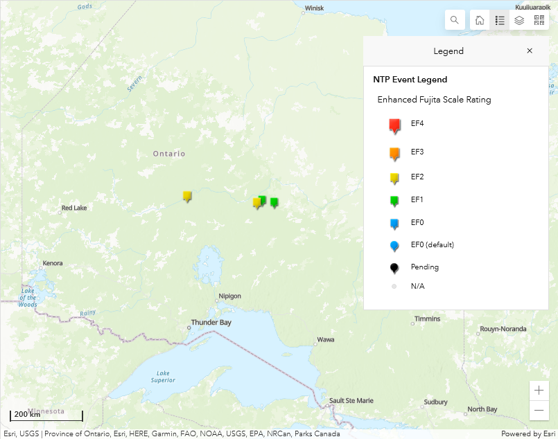
Map showing the locations of the three new tornadoes (eastern-most) and the Woodstock Lake tornado (western-most) that had already been confirmed.
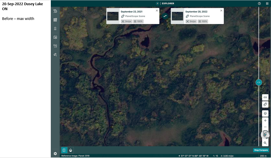
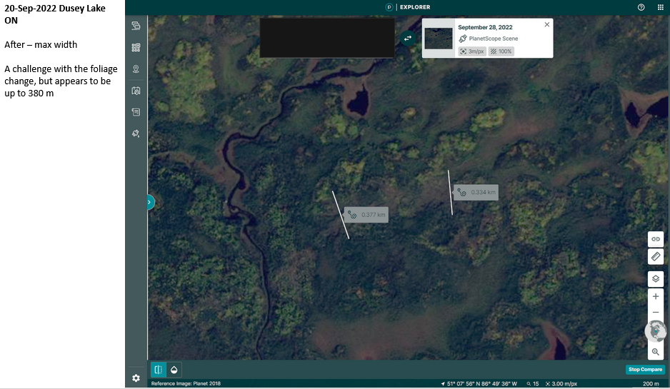
Before and after satellite images showing the tree damage along the path of the Dusey Lake EF2 tornado, with max width measurement superimposed on the after image. This is a good example of the challenge that changing tree leaf colours presents when trying to identify and characterize forest damage.
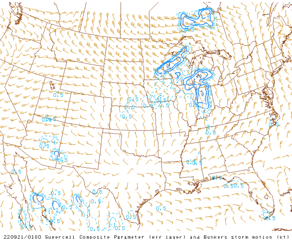
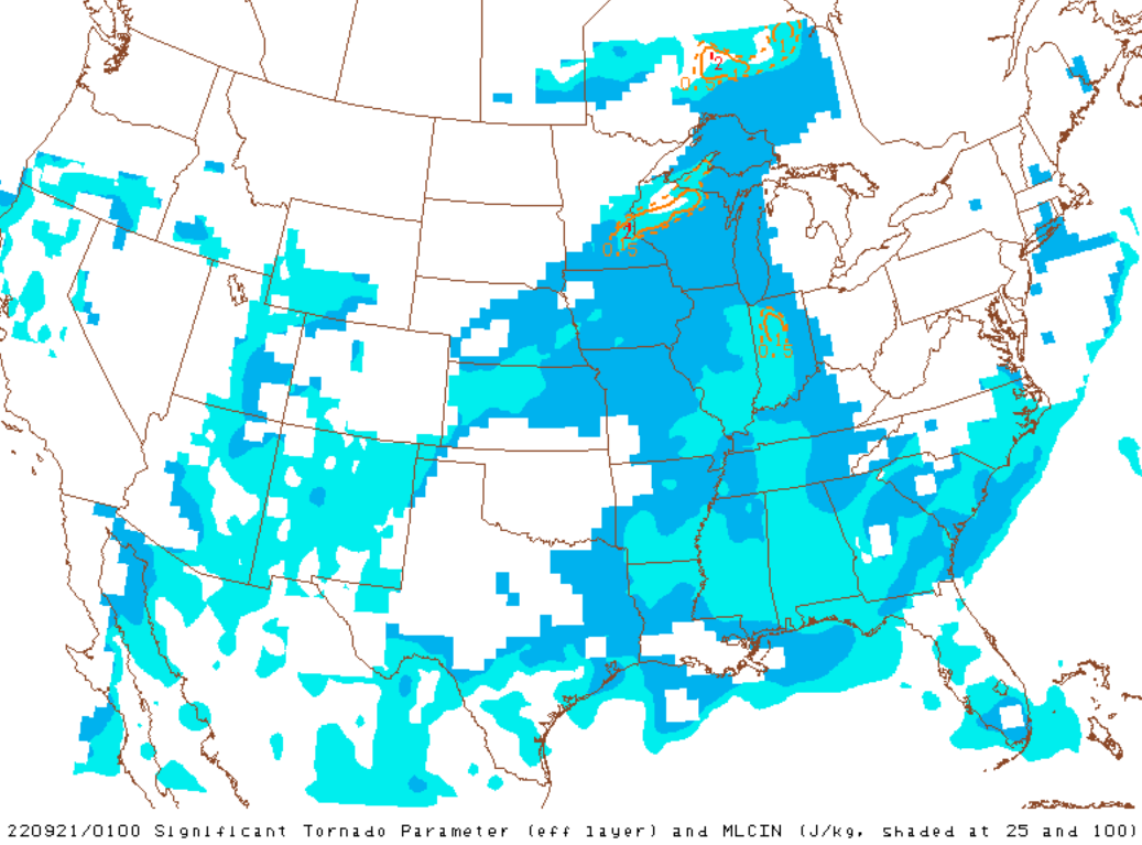
Supercell Composite Parameter and Significant Tornado Parameter output from the US SPC Mesoanalysis valid at 0100 UTC on September 21, just before the tornadoes developed.
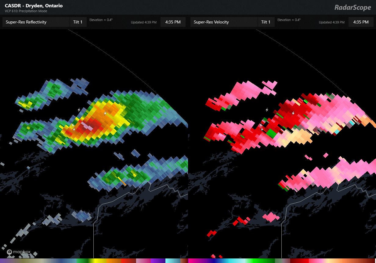
CASDR image with reflectivity (left) and radial velocity (right) showing a supercell beginning to exit the radar domain near 2030 UTC, hours before the tornadoes developed further to the east.