Maps for May 21st derecho and all 2022 ground surveys
With the completion of event summary maps for the individual tornadoes and downbursts that occurred on May 21st as a result of the Ontario-Quebec derecho, NTP has now created event summary maps for all ground and drone surveys from 2022 associated with a damaging tornado or downburst.
These maps can be found on the NTP open data website here.
In total, 30 event summary maps were created from NTP’s 2022 ground and drone surveys. Of these 30 maps, 21 are from events that occurred in Ontario, four are from events that occurred in Quebec, three are from events that occurred in Alberta, and two are from events that occurred in Saskatchewan.
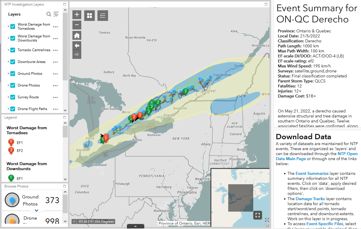
A one-of-a-kind event summary map for the May 21st Ontario-Quebec derecho has also been produced.
This derecho resulted in a continuous path of damage approaching 1000 km in length and 100 km in width, including four EF1 to EF2 tornadoes and nine EF2 downbursts. Two EF1 tornadoes occurred in the city of London, and two EF2 tornadoes occurred in the Durham and Kawartha Lakes regions in Uxbridge and St. Christopher. Sadly, 12 deaths were confirmed with the derecho, as well as at least 12 injuries. This historic event was one of the costliest weather events in Canadian history, with over $1B in insured losses (CatIQ).
The event summary map of the May 21st derecho includes all the data collected from the ground and drone surveys that were conducted by NTP between May 22nd and June 2nd. The map also includes EF Scale contours, depicting the damage intensities in the regions affected by the derecho, based on the review of data from several sources. The event summary map also highlights all the tornadoes and notable downbursts that were produced by the derecho, with links available to individual event summary maps for any derecho-related event that had an associated ground and/or drone survey.