Aug 31st tornadoes in Ontario
NTP investigations have confirmed two August 31st tornadoes in Ontario - one that was a landfalling waterspout at Sauble Beach, ON on the eastern shore of Lake Huron, and another associated with a supercell thunderstorm at Stapledon, ON southwest of Ottawa. Both resulted in EF0 damage.
Full details in the event summaries below.
Event Name: Sauble Beach, ON
Date: August 31, 2022
Start Time: 3:30 PM EDT (1930 UTC)
Final Classification: Tornado (Over Land)
Final EF-Scale Rating: EF0
EF-Scale Damage Indicator / Degree of Damage: FR12/DOD-2
Start of damage track: 44.6619N, 81.2786W
End of damage of track: 44.6515N, 81.2167W
Location of worst damage: 44.6608N, 81.2738W
Description: Witnesses in Sauble Beach captured video and photos of a tornado that developed over Lake Huron around 3:25 PM EDT (1925 UTC) and later came ashore near the Sauble River. Damage to trees, houses and docks was reported. No injuries were reported. An NTP ground/drone survey was completed on September 1, 2022. Damage assessed as EF0 tornado, with an estimated max. wind speed of 125 km/h, track length of 5.0 km and max. path width of 120 m. Tornado motion was from the WNW (approx. 285 degrees). Satellite imagery review is pending.
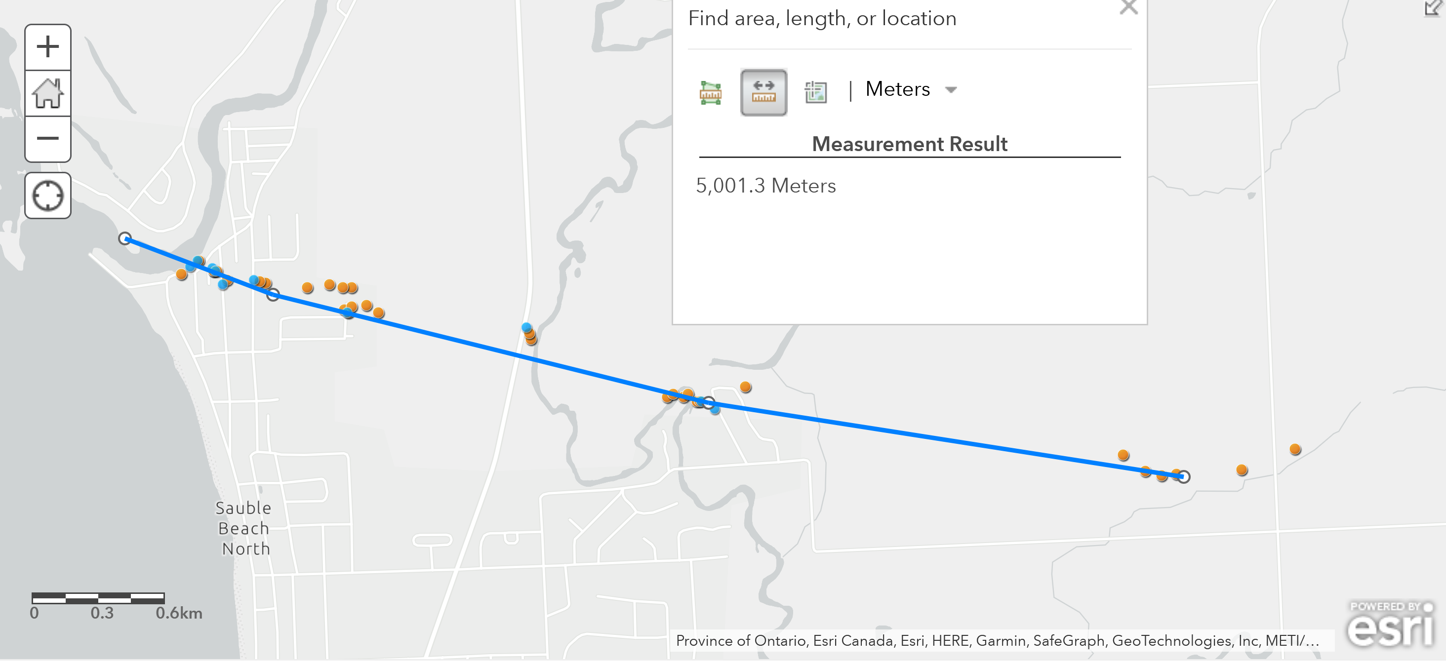
Map of tornado path. Ground photos in blue, drone photos in orange.
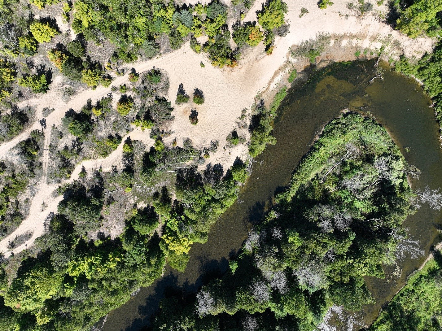
Drone photo of tree damage, showing significant treefall and chaotic treefall patterns.
Event Name: Stapledon, ON
Date: August 31, 2022
Start Time: 5:43 PM EDT (2143 UTC)
Final Classification: Tornado (Over Land)
Final EF-Scale Rating: EF0
EF-Scale Damage Indicator / Degree of Damage: FR12/DOD-2
Start of damage track: 45.1289N, 75.9486W
End of damage of track: 45.1572N, 75.8668W
Location of worst damage: 45.1484N, 75.8863W
Description: Witnesses in areas near Ashton, Prospect and Richmond captured video and photos of a funnel cloud as a storm tracked through the area. Weak tree and shingle damage to houses was reported near Stapledon, along with reports of tossed lawn furniture. No injuries were reported. An NTP ground/drone survey was completed on September 1, 2022. Damage assessed as EF0 tornado, with an estimated max. wind speed of 125 km/h, track length of 7.20 and max. path width of 230 m. Tornado motion was from the WSW (approx. 245 degrees). Satellite imagery review is pending.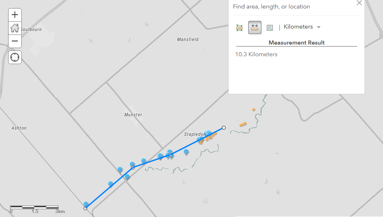
Map of tornado path. Ground photos in blue, drone photos in orange.
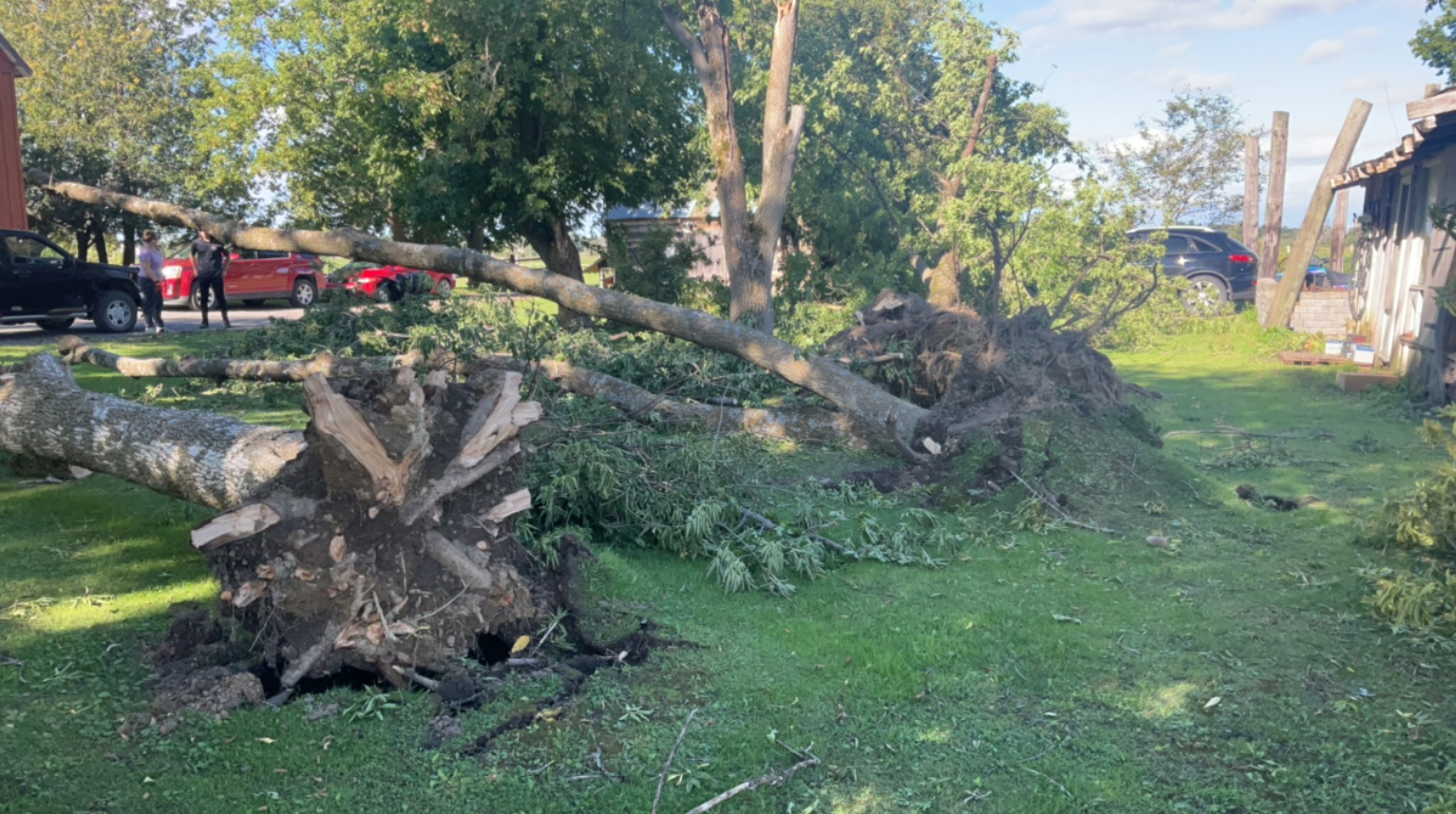
Trees down to the NW and NE in close proximity to one another. There were also other trees on the property down to the W and/or SW. Same location on Highway 10 where the owner reported seeing the tornado go through their property.