Latest from CMRR:
2026 Tanjung Benoa Stress Test Workshop
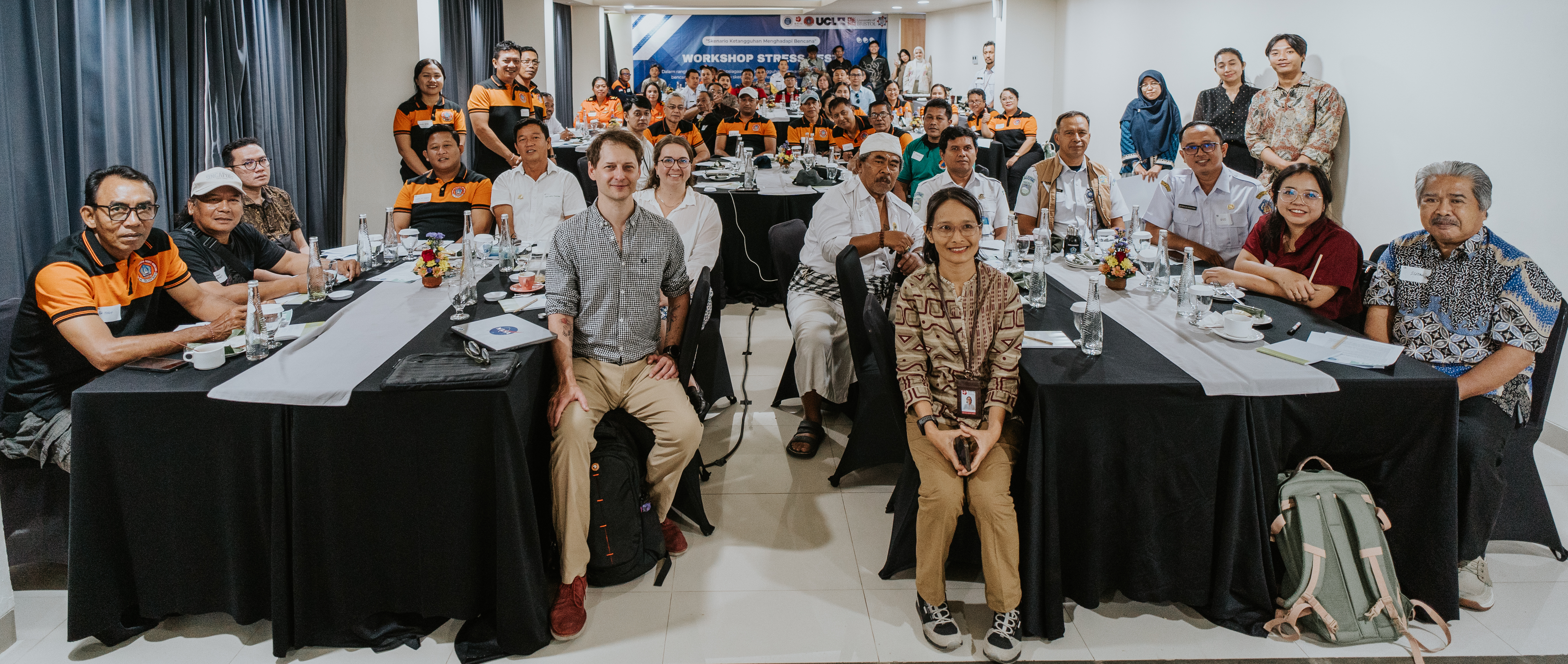
On June 10, 2026, University College London (UCL) and the University of Bristol, in collaboration with the Institute Technology of Bandung (ITB) and CIRCLE, conducted a Community Stress Test Workshop in Tanjung Benoa.
CBC Science News
Tofino's tsunami preparedness has been discussed in the CBC Science News (link) in relation to the recent publication (link).
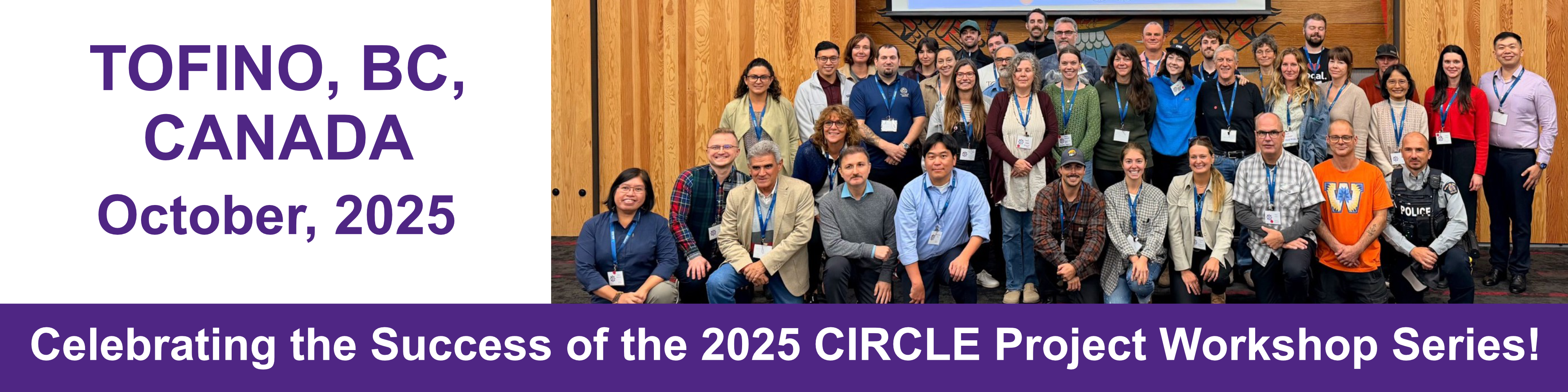
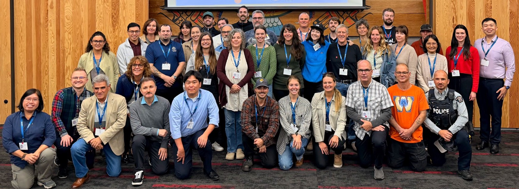
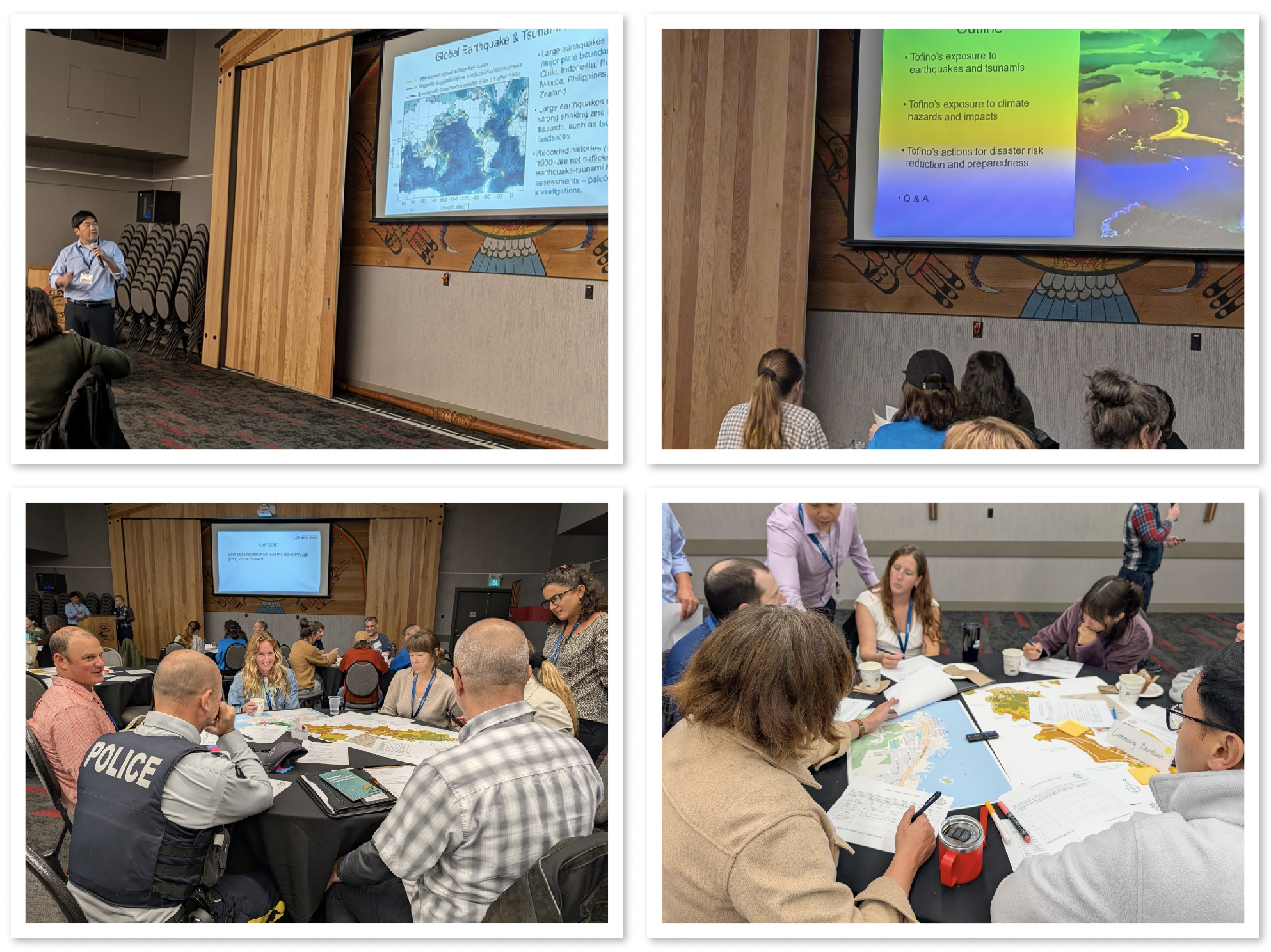
2026 Tofino Workshop
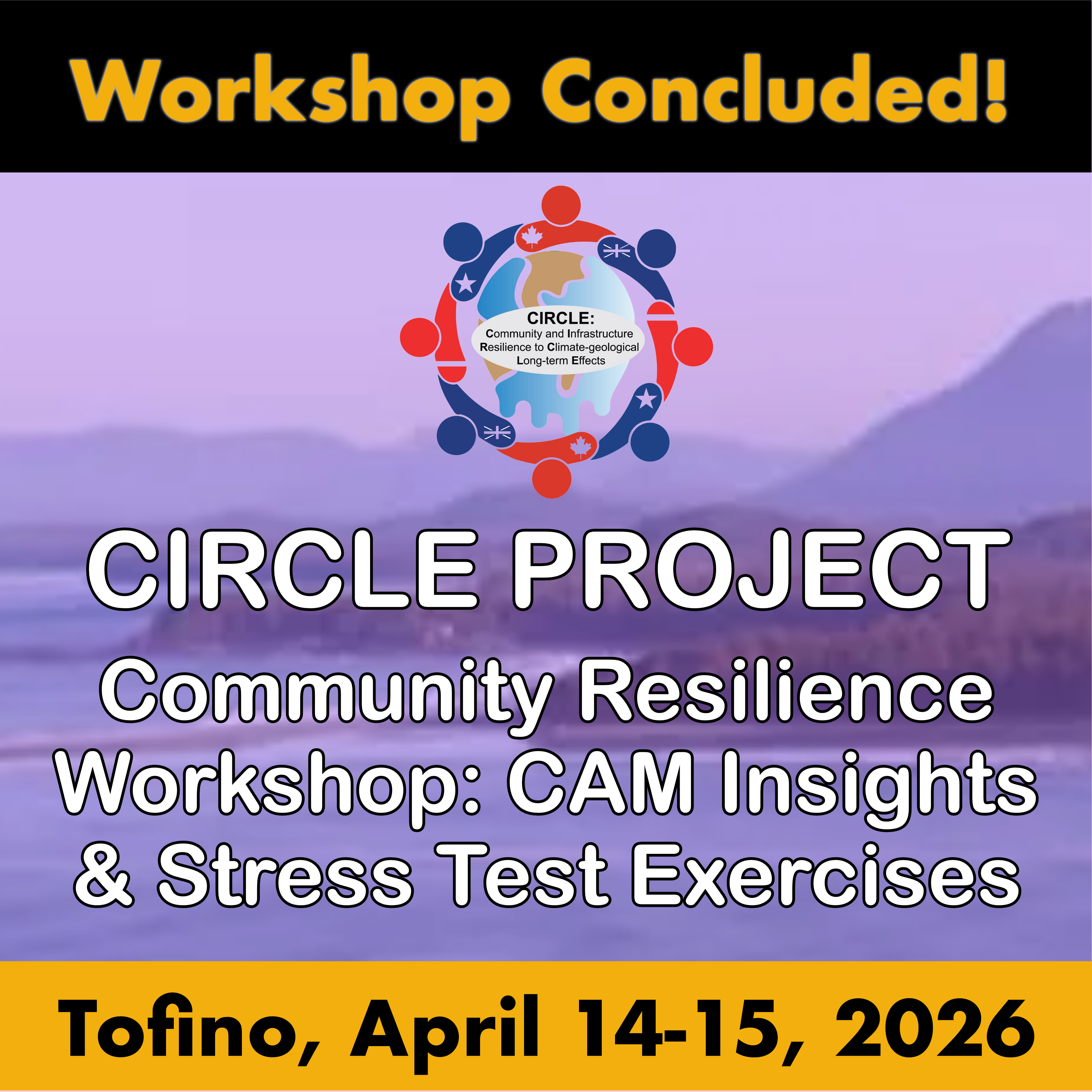
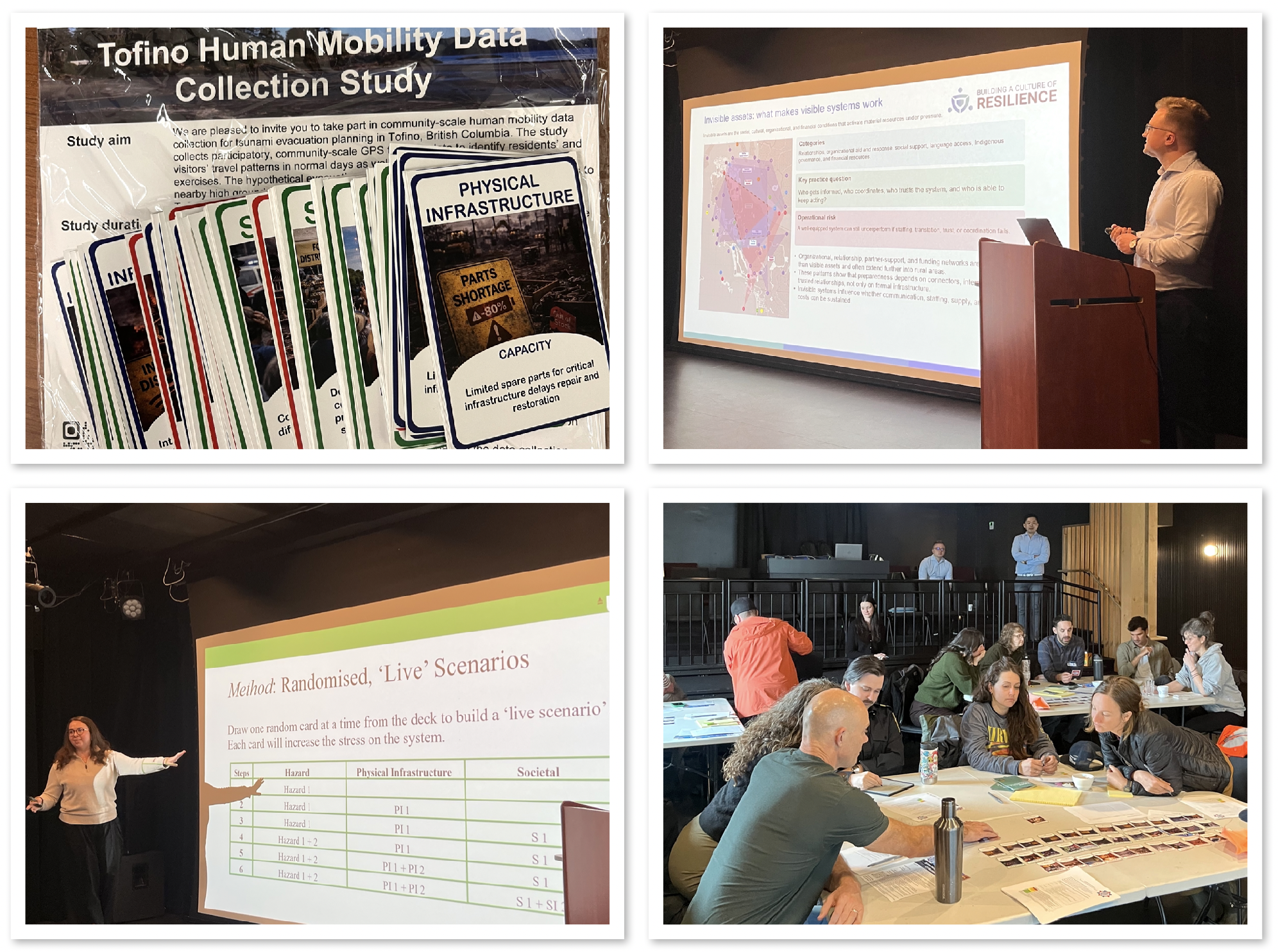
Thank you to all our speakers, participants, and partners for making the Tofino Community Resilience Workshop: CAM Insights & Stress Test Exercises both inspiring and rewarding.
Key insights and highlights from the Tofino CAM & Stress Test Workshop Summary is now online!
SPARK Seminar
Dr. Ke He (School of Civil, Aerospace and Design Engineering, University of Bristol, UK) will present a seminar titled “A Multi-Stage Framework for Modelling Flood-Induced Disruptions in Urban Road Networks” as part of our seminar series on April 17, 2026.Learn more—view the seminar flyer.

Discover IOCEA 2026
We are pleased to share information about IOCEA 2026, organized by SciForum. The 1st International Online Conference on Earth Science (IOCEA 2026) will be held online from 2–4 September 2026. Registration is free. Learn more at Sciforum.net
Disaster Preparedness
The Guardian reports that Tofino, a popular surf town on British Columbia’s Vancouver Island, is intensively preparing for a possible major tsunami linked to the region’s tectonic plate boundary.
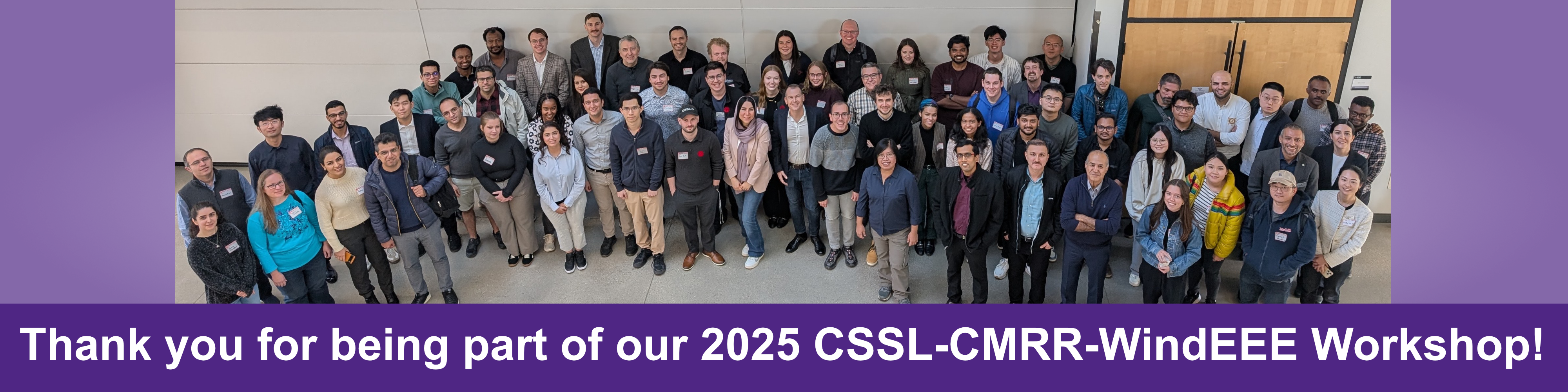
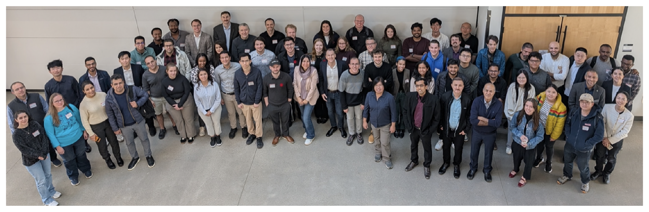
Workshop Series
Grateful to all our speakers, participants, and partners for making the 2025 CSSL-CMRR-WindEEE Multi-hazard Risk and Resilience Workshop an inspiring and productive event!
Workshop recording is now available to watch online.
Thanks to all our speakers, participants, and partners for making the Tofino workshop such a memorable and productive experience!
Thank you for joining us! TOFINO WORKSHOP summary and highlights NOW ONLINE!
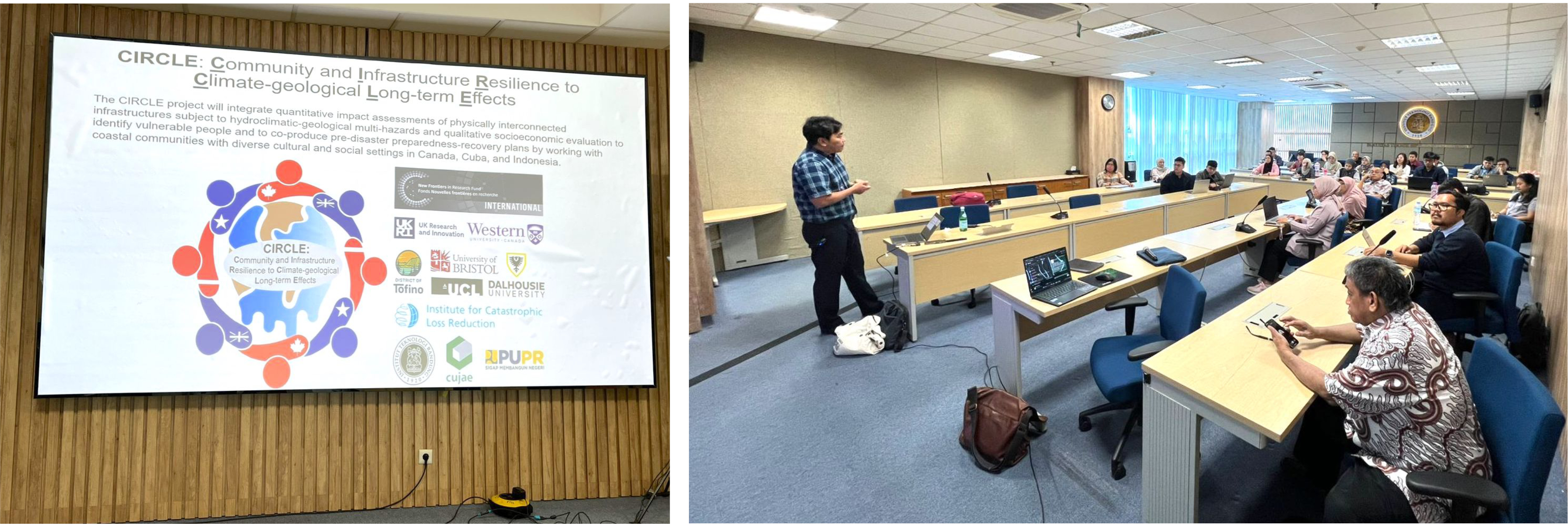
A Visit and Lecture at Bandung Institute of Technology (ITB: Institut Teknologi Bandung)
Earlier this month, Dr. Katsuichiro Goda of Western University, lead of the CIRCLE Project, visited ITB in Indonesia as part of an international collaboration with partners from Indonesia, Canada, and Cuba. He gave a guest lecture to students and faculty from Civil Engineering and Actuarial Science, sparking meaningful academic exchange and dialogue.
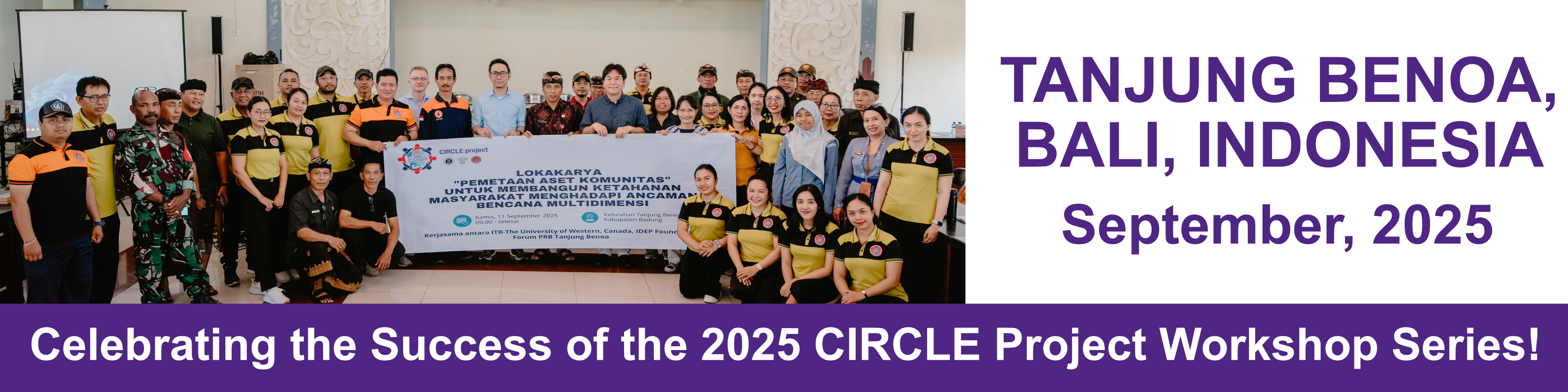
Bali Workshop
The Bali workshop was successfully conducted, bringing together participants for an engaging and productive learning experience.
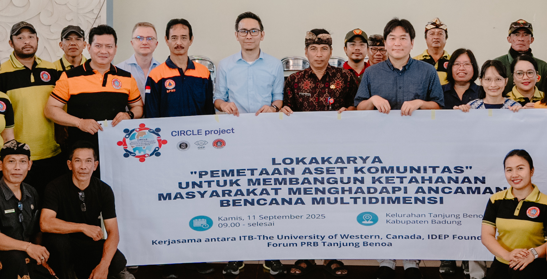
Key insights and highlights from the Bali Workshop Now Online!
New PublicationS
Multi-Hazard Shaking-Tsunami Fatality Risk Estimation for Coastal Communities
Abstract
This study develops a multi-hazard fatality risk model for a coastal community (Tofino) on Vancouver Island, Canada, subjected to earthquake-tsunami threats from the Cascadia subduction megathrust events. The model incorporates variable population distributions and uncertain fatality rate models, in addition to other key model components, such as time-dependent earthquake occurrence, stochastic rupture source, ground motion simulation, and tsunami inundation simulation. Using the developed risk model, exceedance frequency (F) plots in terms of the number of anticipated fatalities (N) are derived for single-hazard and multi-hazard cases. The F-N curves can be used for evaluating the adequacy of current earthquake-tsunami risk situations, compared with the acceptable risk tolerability limits. The obtained F-N curves for Tofino intersect with the local scrutiny line set by the UK Health and Safety Executive, indicating that the earthquake-tsunami risk levels for Tofino residents and visitors fall within the As Low As Reasonably Practicable (ALARP) region. Thereby, when effective risk mitigation measures are available, such actions should be pursued. Moreover, the community-level earthquake-tsunami risk management approach is discussed by considering joint characteristics of fatality and financial risks. The results show very different risk characteristics of the fatality and financial risks due to intense ground motions and tsunami inundations. Such multivariate risk quantification will be essential because more generalized risk management approaches are adopted and implemented across technological and disaster risk domains.
Citation: Goda, K. (2026). Multi-hazard shaking–tsunami fatality risk estimation for coastal communities. Earthquake Engineering & Structural Dynamics. Advance online publication. https://doi.org/10.1002/eqe.70220
An exploratory forward sortation area-level analysis of social vulnerability change and insured disaster losses in Canada
Abstract
Understanding how social vulnerability evolves over time is essential for assessing broad patterns of societal exposure to hazards. This study develops and compares Social Vulnerability Index (SoVI) scores for Canadian Forward Sortation Areas (FSAs) using the 2016 and 2021 Census data, providing a national-level, spatially explicit exploratory assessment of temporal changes in vulnerability and their spatial correspondence with insured disaster losses across Canada. Principal component analysis (PCA) is applied to derive underlying socioeconomic dimensions, and both SoVI and a standardized socioeconomic status (SES) index are constructed using consistent methodologies to enable cross-year comparison. Spatial patterns are examined using global and local Moran's I and Getis–Ord Gi∗ statistics to identify clustering, including hot spots and cold spots of vulnerability. Relative comparisons suggest that from 2016 to 2021, Canadian FSAs experienced modest increases in SoVI alongside general declines in SES, being consistent with broader national-scale patterns of higher vulnerability and lower socioeconomic conditions. Both indicators exhibit significant spatial clustering, with high–high clusters most prevalent in parts of Alberta, Saskatchewan, and Manitoba. Local Moran's I results align with Getis–Ord Gi∗ hotspot analysis, indicating regionally concentrated vulnerability patterns. A spatial comparison of socio-economic vulnerability (SoVI and SES) and cumulative insured disaster losses reveals both areas of alignment and divergence across FSAs. Insured loss captures an important dimension of disaster impact shaped by exposure, asset values, and insurance coverage, providing a valuable lens for examining national-scale patterns. Framed as an exploratory, national-scale screening exercise, the study leverages FSAs to enable consistent linkage with insured-loss data across Canada, while acknowledging that casuality of these spatial relationships cannot be concluded and finer-scale heterogeneity lies beyond its scope. The results offer a broad benchmarking perspective on the relationship between social vulnerability and insured losses, helping to guide and prioritize more detailed future analyses.
Citation: Roosmawati, N., & Goda, K. (2026). An exploratory forward sortation area-level analysis of social vulnerability change and insured disaster losses in Canada. International Journal of Disaster Risk Reduction, 141, Article 106209. https://doi.org/10.1016/j.ijdrr.2026.106209
SoVI Algorithm and MATLAB Implementation Manual: Analysis Using Canada Census 2016 / 2021 Data
We are pleased to announce the public release of the SoVI Algorithm and MATLAB Implementation Manual: Analysis Using Canada Census 2016 / 2021 Data, now openly available on Zenodo.
Read the Details
Citation: Roosmawati, N., & Goda, K. (2025). SoVI Algorithm and MATLAB Implementation Manual: Analysis Using Canada Census 2016 / 2021 Data (1.0.0) [Data set]. Zenodo. https://doi.org/10.5281/zenodo.17635568
Risk-based multi-hazard microzonation for earthquakes and tsunamis
Read the Abstract
Citation: Goda, K., & Catalan, P. A. (2025). Risk-based Multi-hazard Microzonation for Earthquakes and Tsunamis. Frontiers in Earth Science, 13, 1568069. https://doi.org/10.3389/feart.2025.1568069
You can find the article in Frontiers in Earth Science
List of Publications from the CIRCLE Projects Across Various Study Areas
A Dynamic Bayesian Network Approach to Characterize Multi-Hazard Risks and Resilience in Interconnected Critical Infrastructures
Citation: Bakhtiari, S., Najafi, M. R., Goda, K., & Peerhossaini, H. (2025). A Dynamic Bayesian Network Approach to Characterize Multi-Hazard Risks and Resilience in Interconnected Critical Infrastructures. Reliability Engineering & System Safety, 1–18. https://doi.org/10.1016/j.ress.2025.110815
You can find the article in Reliability Engineering & System Safety Journal
List of Publications from the CIRCLE Projects Across Various Study Areas
Effect of Calibration Data on Performance of Tsunami Early Warning Model
Read the Abstract
Citation: Goda, K., Chamatidis, I., & Istrati, D. (2025). Effect of calibration data on performance of tsunami early warning model. Coastal Engineering Journal, 1–18. https://doi.org/10.1080/21664250.2025.2516324
You can find the article in Coastal Engineering Journal OR request via researchgate.net
List of Publications from the CIRCLE Projects Across Various Study Areas
Quick Loss Estimation Tool (QLET) for Seismic Risk Assessment in Canada
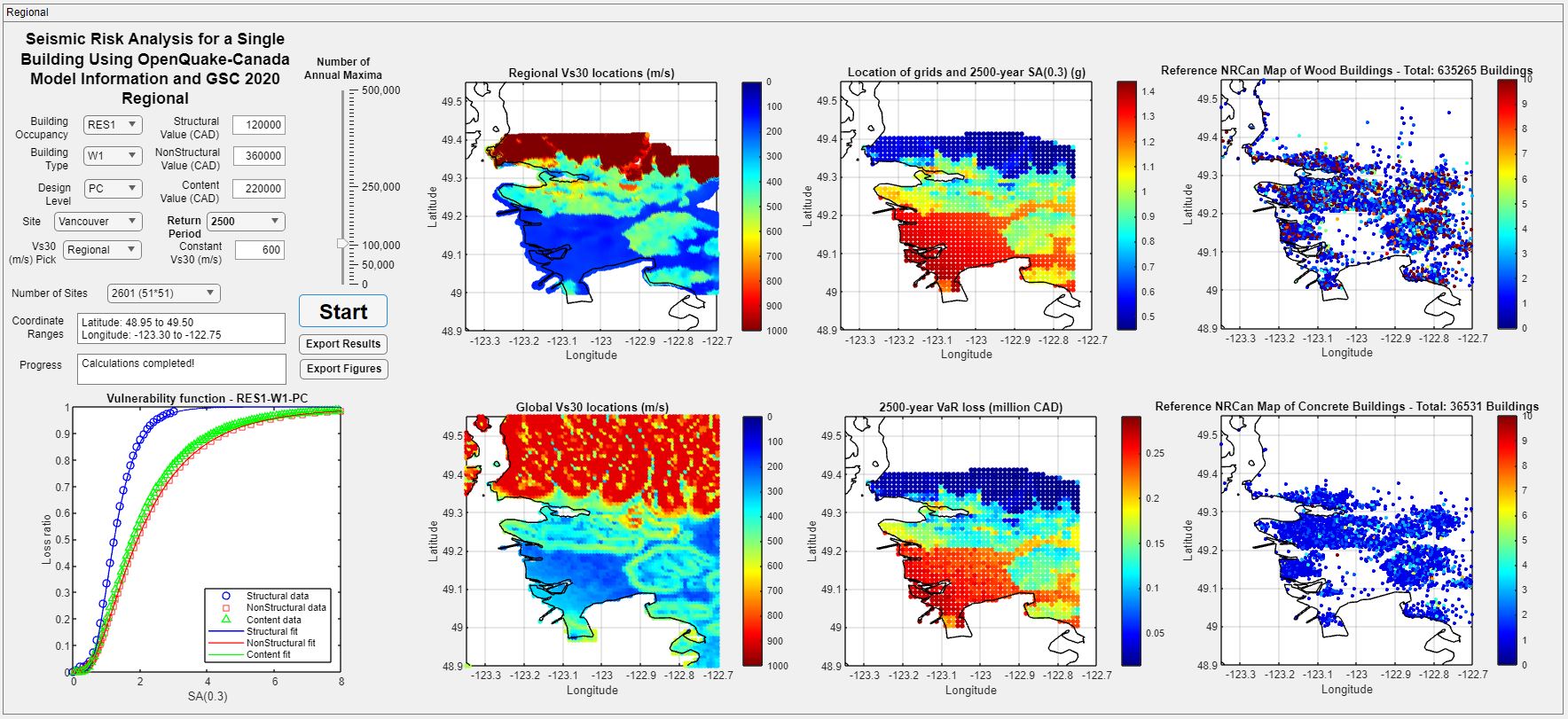
A new peer-reviewed article has been published in GeoHazards titled:
“Rapid Computation of Seismic Loss Curves for Canadian Buildings Using Tail Approximation Method”
Authors: Payam Momeni, Katsuichiro Goda, Navid Sirous, and Sheri Molnar
Read the Abstract
QLET is freely available as an open-source repository on GitHub, providing both the MATLAB codes and GUI-based application for users and researchers:
https://github.com/pmomeni/QuickLossEstimationTool_QLET
Read the full article:
https://www.mdpi.com/2624-795X/6/2/26
Say Hello to CMRR
Thrilled to announce the establishment of the Centre for Multihazard Risk and Resilience (CMRR) at Western University. #CMRR #WesternUniversity #ResilienceInAction #ClimateChange #InfrastructureResilience #Equity #RiskandResilience #NaturalHazards #DRR #InterdisciplinaryResearch
— Reza Najafi (@RezaNajafi61) September 23, 2023
Program Contacts
Katsuichiro Goda & Reza Najafi
Co-Directors, Centre for Multi-hazard Risk and Resilience (CMRR)
Contact info:
kgoda2@uwo.ca
mnajafi7@uwo.ca
CIRCLE Project
CIRCLE Project: Strengthening community resilience across Canada, Cuba, and Indonesia — learn more.
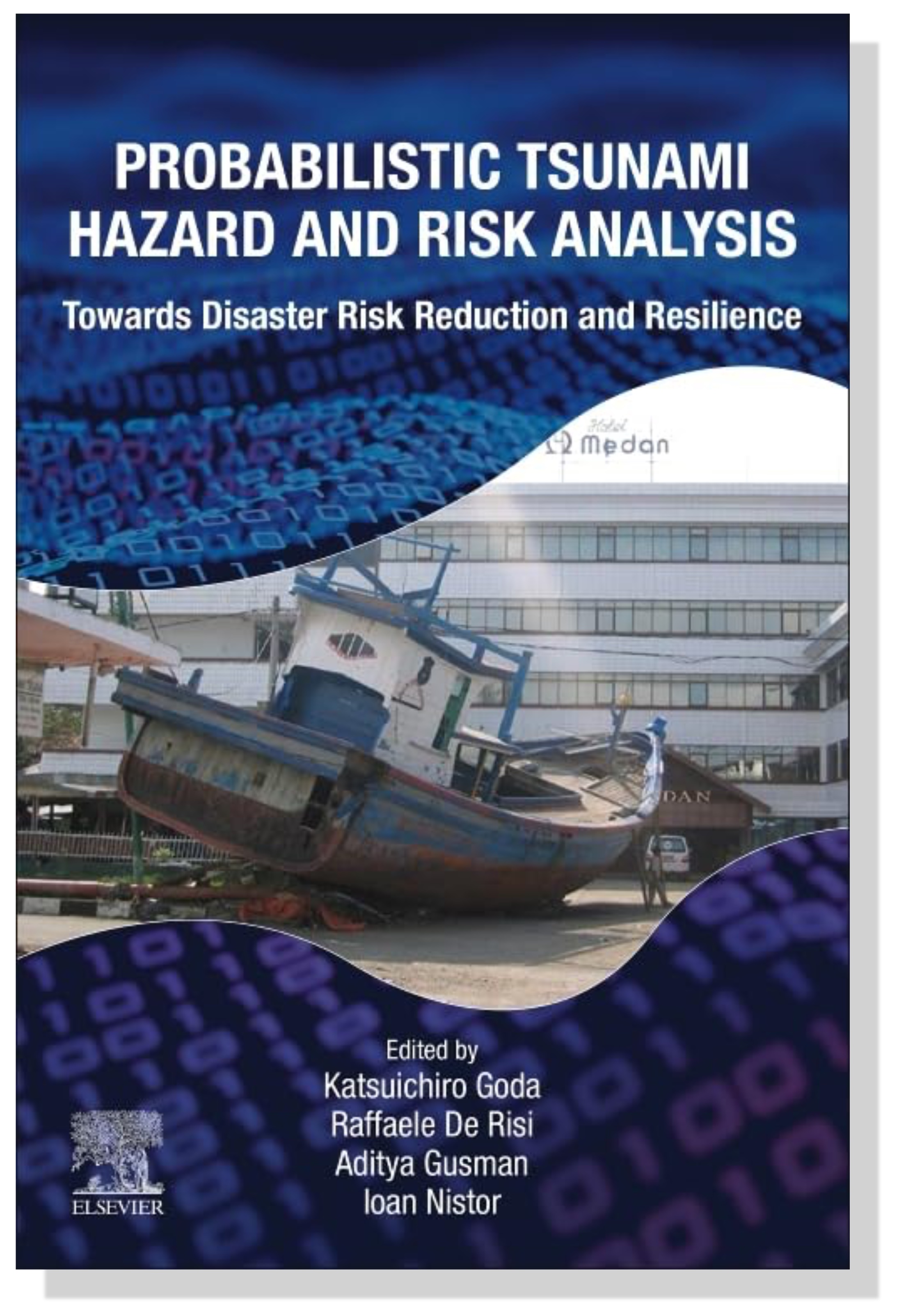
Textbook on Probabilistic Tsunami Hazard and Risk Analysis Now Published
Dr. Katsuichiro Goda led the editing of the first textbook on 'Probabilistic Tsunami Hazard and Risk Analysis', published by Elsevier. More information can be found on Elsevier website.
This website is maintained by Dr. Nova Roosmawati. For any feedback or suggestions, please contact nroosmaw@uwo.ca