Two tornadoes and a downburst in SW ON on Sep 3
The NTP has confirmed an EF1 tornado in east Windsor and an EF1 tornado and EF1 downburst in Wheatley, all in southwestern Ontario, with the line of intense storms that crossed the region on September 3.
At Windsor, the fast-moving tornado started in Detroit and crossed the Detroit River at Belle Isle. One Windsor home just inland from the Detroit River had its roof thrown 80 m and there were trees and large tree branches down from the Detroit River shore toward the south-southeast over a swath over 1 km wide. Detroit radar indicated a tornado debris signature given debris was lofted into the air.
At Wheatley, a tornado was observed and it threw debris in multiple directions when it hit a recently built drive shed. The damage there was assigned an EF1 rating. To the south of the tornado, a wall of wind and rain hit the town as a downburst caused significant tree damage rated at EF1. It also toppled two tractor-trailers.
Full details are available with the event summaries below, along with a regional map, survey summary maps, survey photos and radar images. The events can also be plotted on a map using the NTP Dashboard here.
====
Event Name: Windsor (Riverside), ON
Date: September 3, 2026
Start Time: 4:18 PM EDT (2018 UTC)
Final Classification: Tornado (over land)
Final EF-Scale Rating: EF1
EF-Scale Damage Indicator / Degree of Damage: FR12/DOD-6
Start of damage track: 42.3310N, 82.9762W
End of damage track: 42.2924N, 82.9146W
Location of worst damage: 42.3303N, 82.9756W
Description: Damage to several structures, including significant roof loss to a home, tree damage and a toppled trailer was reported Windsor after a storm passed through (most notably impacting parts of the Riverside, East Windsor and Fontainbleu neighbourhoods). Witnesses also captured video of lofted debris. No injuries were reported. An NTP ground and drone survey was completed on September 4, 2026, documenting the reported damage and some additional damage in the neighbourhood of Forest Glade. Damage assessed as EF1 tornado, with an estimated max. wind speed of 165 km/h, track length of 7.0 km and max. path width of 1.1 km. Tornado motion was from the NW (approx. 310 degrees). Start time is radar estimated. Satellite imagery review is pending. The tornado initially developed in Detroit, MI (start point approx. 42.3685N, 83.0291W), where it caused up to EF2 damage before crossing the Detroit River into Ontario.
Event Name: Wheatley, ON
Date: September 3, 2026
Start Time: 4:48 PM EDT (2048 UTC)
Final Classification: Tornado (over land)
Final EF-Scale Rating: EF1
EF-Scale Damage Indicator / Degree of Damage: SBO/DOD-4
Start of damage track: 42.1168N, 82.4868W
End of damage track: 42.1097N, 82.4119W
Location of worst damage: 42.1122N, 82.4245W
Description: Damage to a large barn, trees, two toppled transport trucks and minor roof damage to a home was reported in and around Wheatley after a storm passed through. No injuries were reported. An NTP ground and drone survey was completed on September 4, 2026, documenting both tornado and downburst damage in the area. The damage north of Wheatley, including the barn damage, was assessed as EF1 tornado, with an estimated max. wind speed of 145 km/h, track length of 6.3 km and max. path width of 450 m. Tornado motion was from the W (approx. 275 degrees). Start time is radar estimated. Satellite imagery review is pending. The downburst damage in Wheatley was assessed as EF1.
Event Name: Wheatley (downburst), ON
Date: September 3, 2026
Start Time: 4:45 PM EDT (2045 UTC)
Final Classification: Downburst
Final EF-Scale Rating: EF1
EF-Scale Damage Indicator / Degree of Damage: C-T/DOD-4
Location of worst damage: 42.1054N, 82.4598W
Description: Damage to a large barn, trees, two toppled transport trucks and minor roof damage to a home was reported in and around Wheatley after a storm passed through. No injuries were reported. An NTP ground survey was completed on September 4, 2026, documenting both tornado and downburst damage in the area. Downburst damage that impacted primarily trees in the community of Wheatley was assessed as EF1, with an estimated max. wind speed of 150 km/h, with damage found over an area approximately 5.3 km long and up to 4.7 km wide. Start time is radar estimated. Satellite imagery review is pending. The tornado damage north of Wheatly was assessed as EF1.
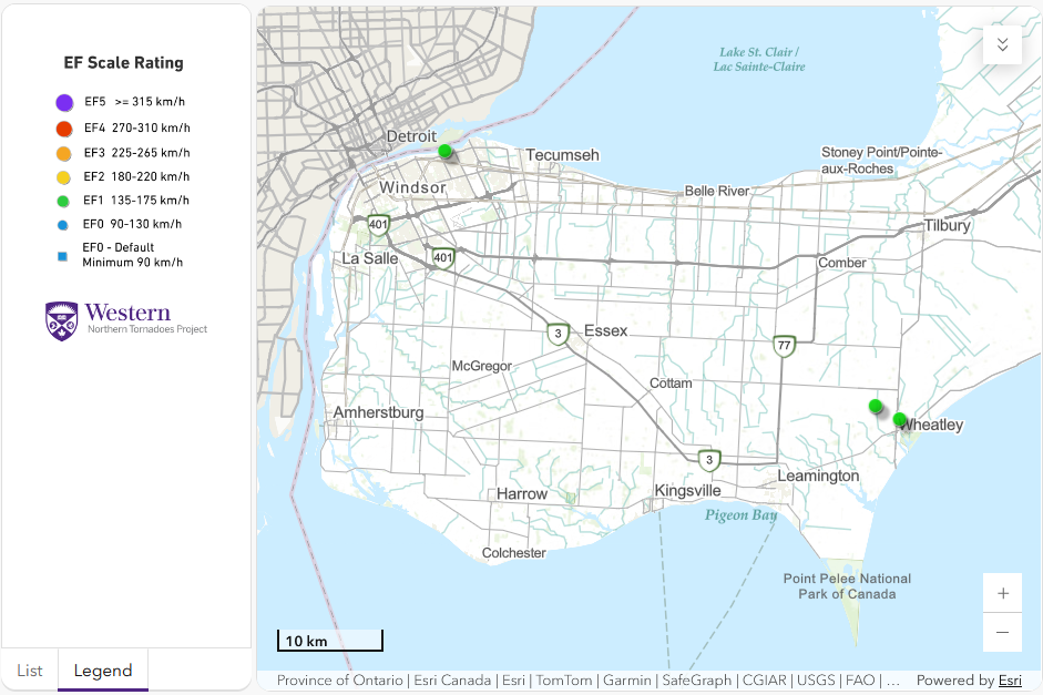
Regional map showing the start locations of the Windsor EF1 tornado and the Wheatley EF1 tornado and EF1 downburst.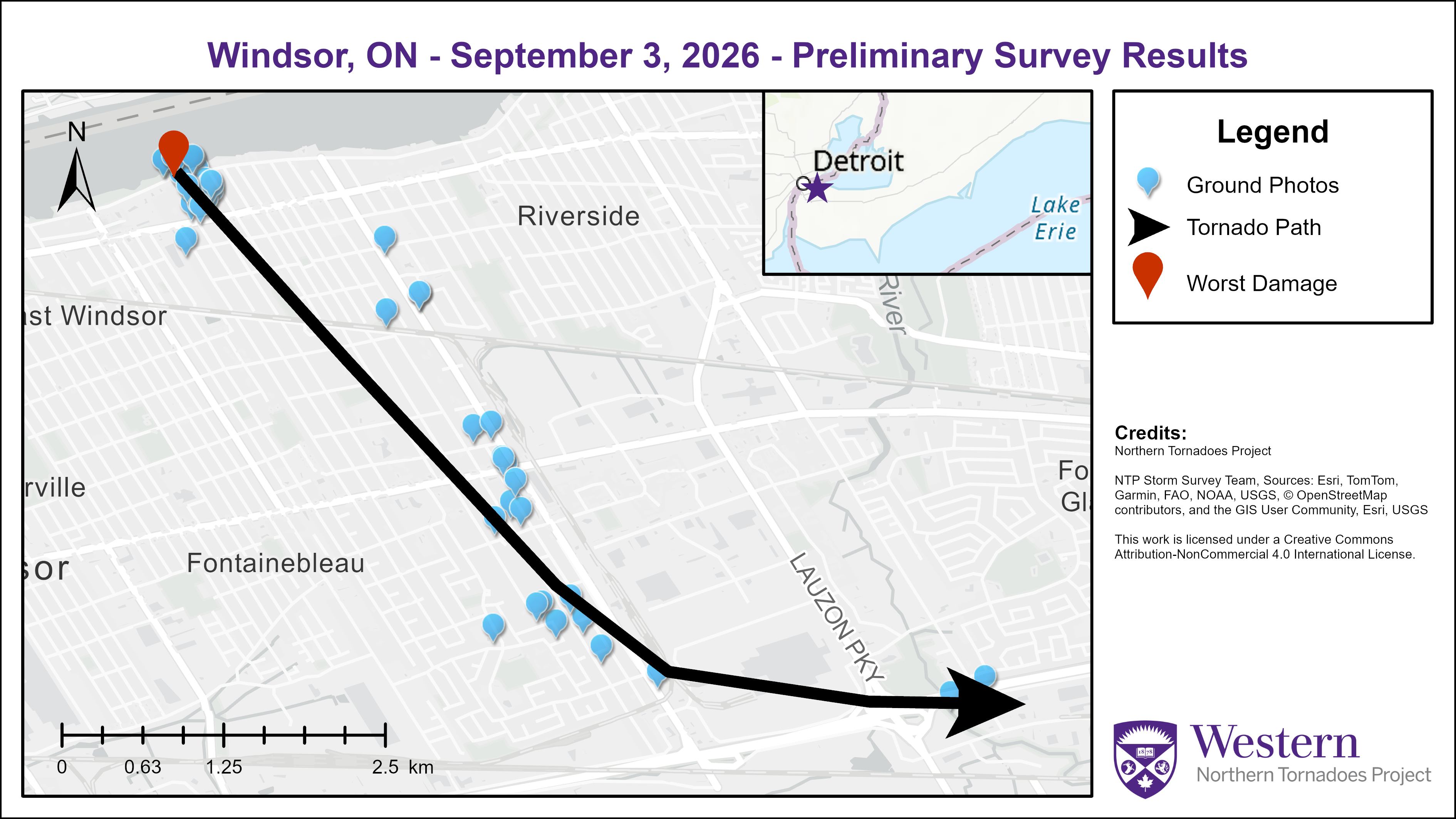
Survey map showing the track of the Windsor EF1 tornado.

Survey map showing the track of the Wheatley EF1 tornado and the extent of the Wheatley EF1 downburst.
Survey photo of worst damage point - a house with missing roof and damaged wall at Riverside and Buckingham.

The roof from the previous photo landed 80 m away on the front lawn of this house on a street to the east.
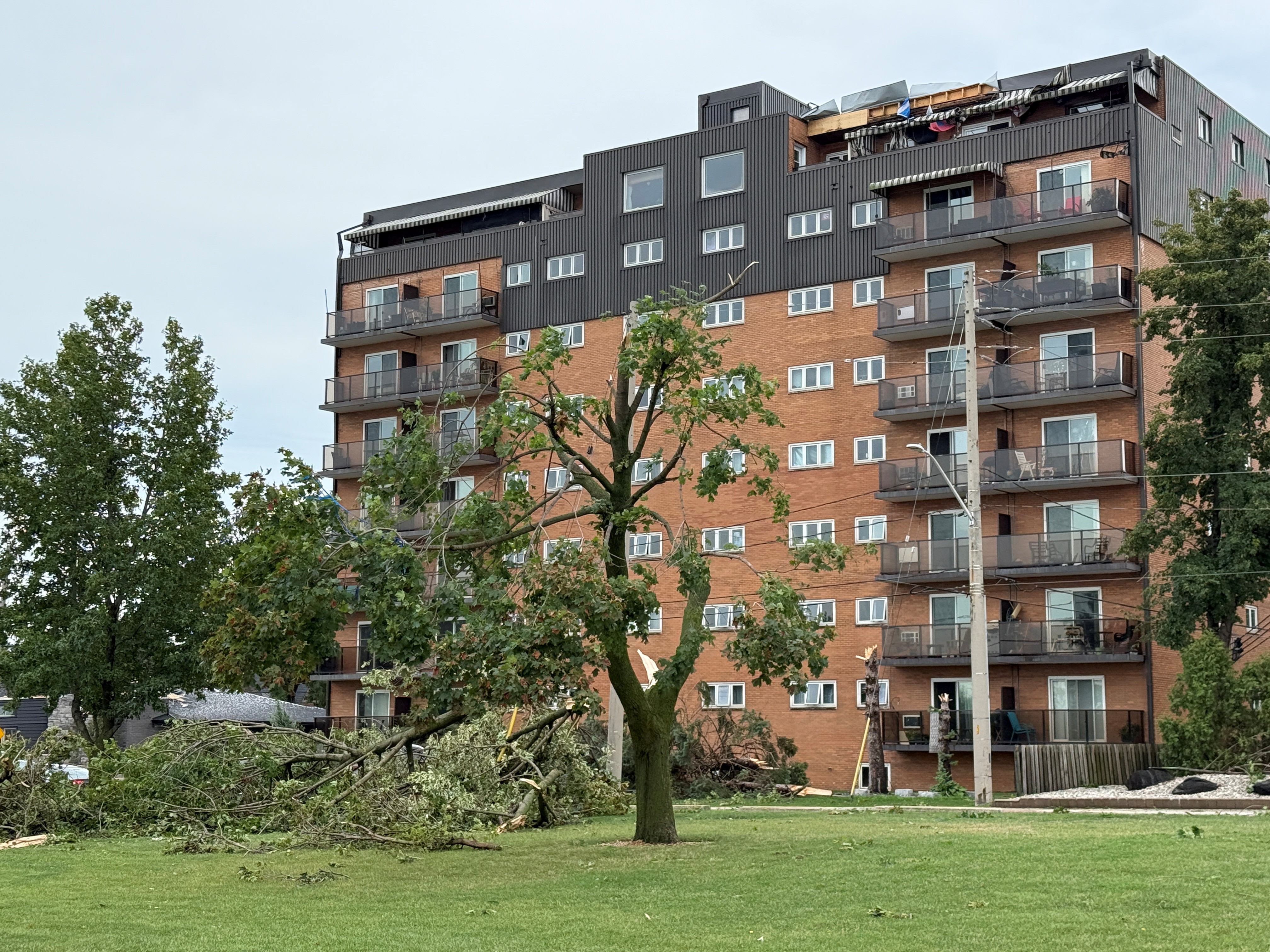
Survey photo of riverside park and apartment building with signficant tree damage and structural damage.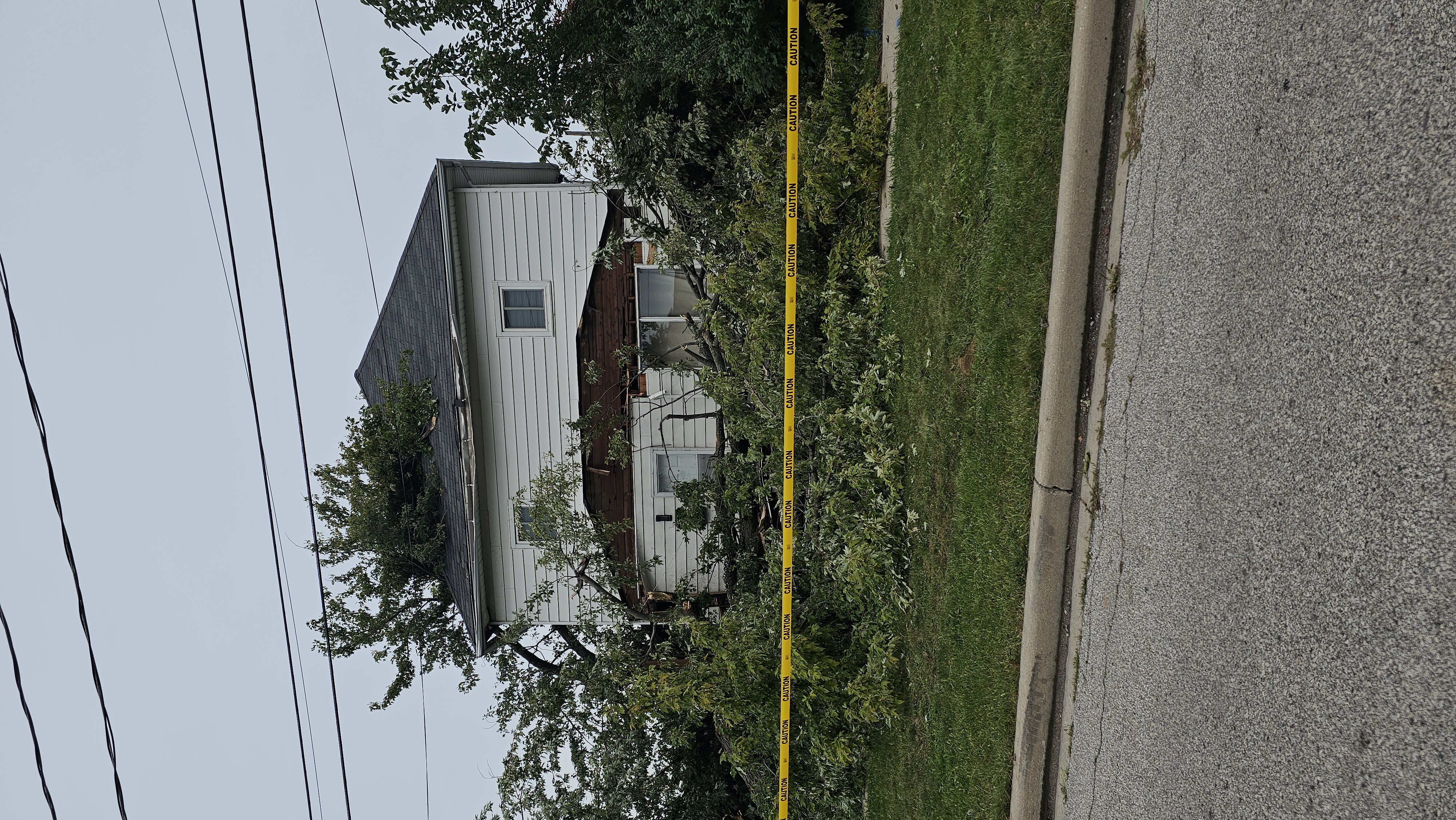
Survey photo of house near Tecumseh Road with roof damaged by falling large tree branches.
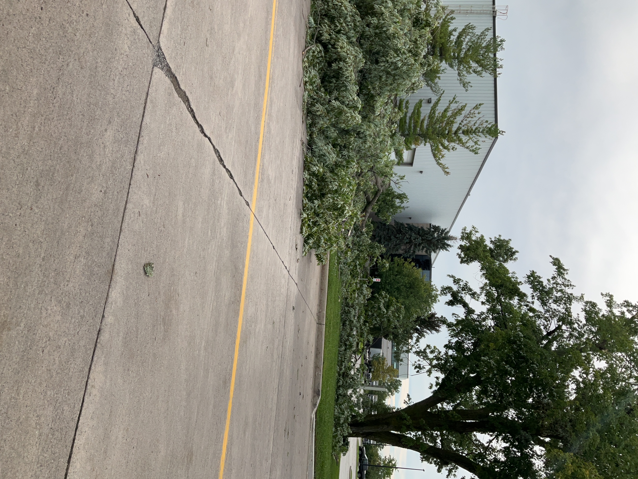
Survey photo near the end of the tornado track showing large branches down.
Survey photo from the Wheatley tornado showing a large drive shed with one wall pushed in and part of its roof lost. Debris can be seen strewn in the field to the left. Other large debris was thrown to the right of the shed. A witness at this location saw swirling debris in the air.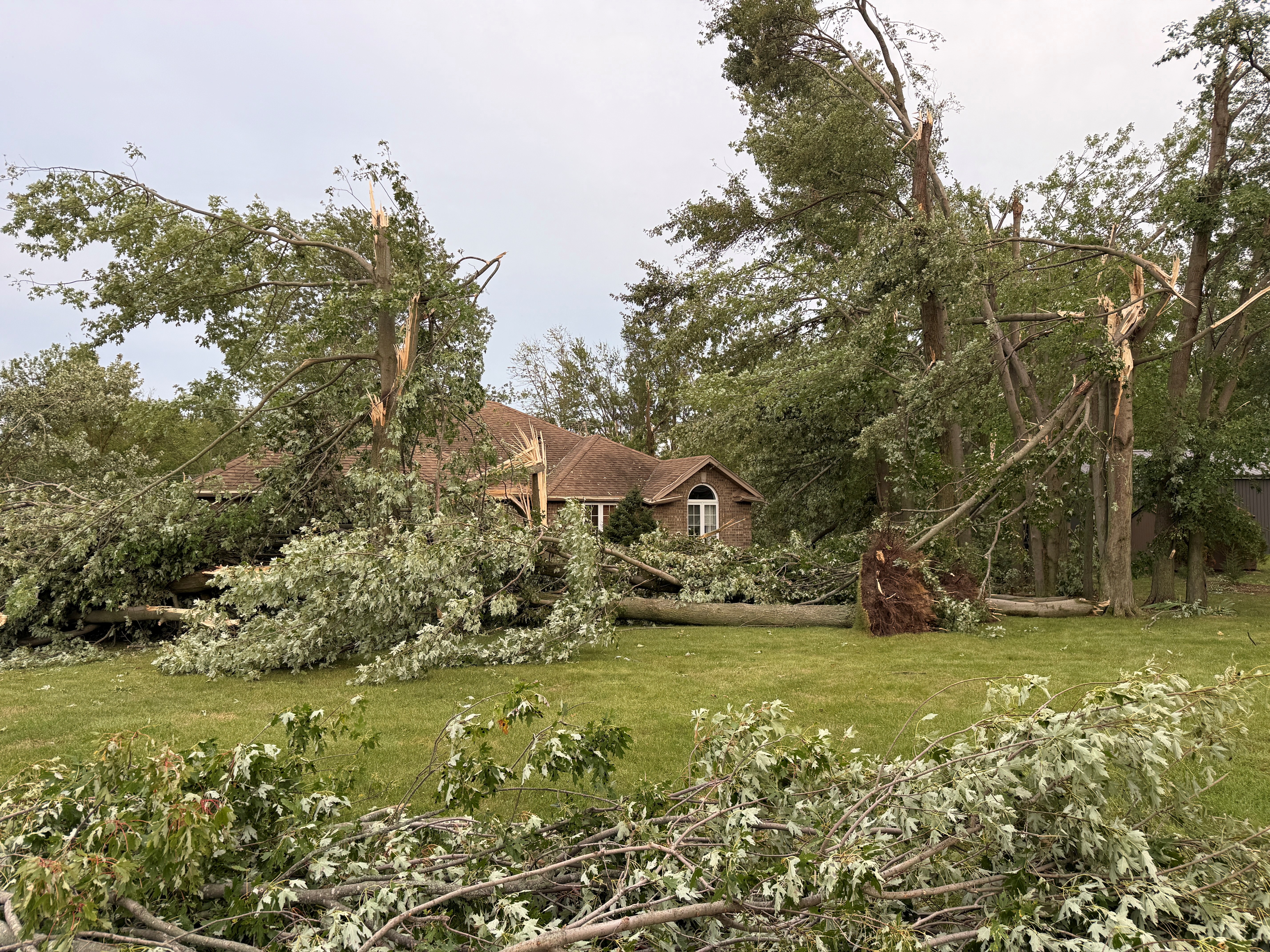
Survey photo from the Wheatley downburst showing significant tree damage, including large snapped and uprooted trees. A witness near this location described a wall of rain and wind the moved in and lasted for up to 15-20 minutes.
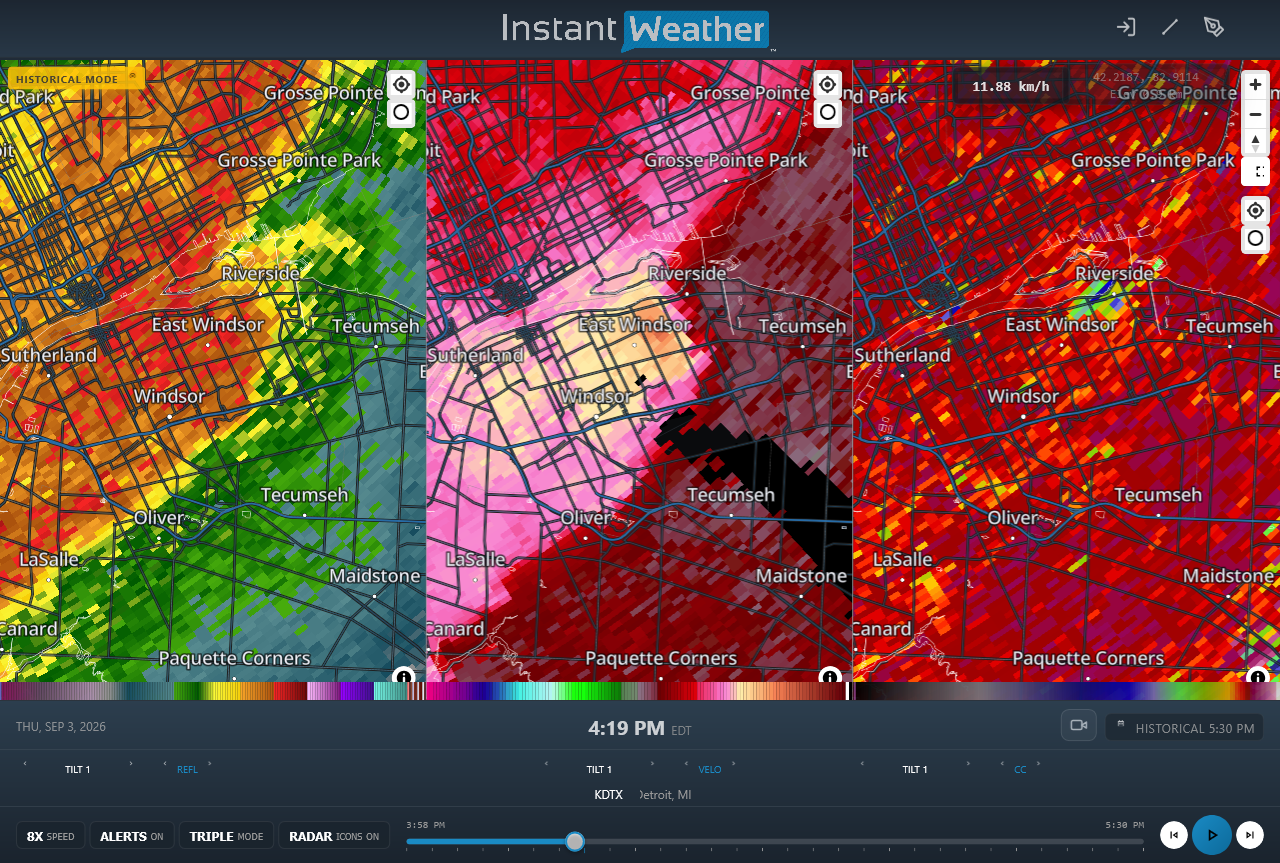
DTX radar image showing reflectivity (left), Doppler radial velocity (centre) and Correlation Coefficient (right) products at the time that the Windsor tornado was causing EF1 damage. Note the blue area in the right panel near Riverside indicating a tornado debris signature.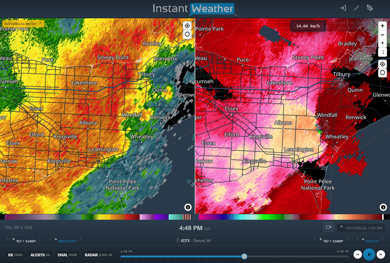
DTX radar image showing reflectivity (left) and Doppler radial velocity (right) products at the time that the Wheatley EF1 tornado and EF1 downburst were causing damage. Note the area of compact rotation at right with green indicating winds toward the radar and pink indicating winds away from the radar.


