Two tornadoes and a downburst in SW ON on Sep 2
Following a thorough ground and drone survey and analysis of results, the NTP has confirmed two tornadoes and a downburst in the Tavistock area of southwestern Ontario on September 2. These occurred with the passage of an intense line of late afternoon storms.
The first tornado began west of Tavistock and tracked into the town, causing tree and house shingle damage rated at EF0. It carved a clear path through crops along its path.
A second tornado began north of Tavistock near Shakespeare and tracked toward the southeast. This tornado caused significant damage to agricultural structures and trees rated at EF1. Its path could also be clearly seen at times in crops.
Finally, both tornadoes converged toward a downburst that developed just east of Tavistock and travelled more than 17 km toward the east-southeast. EF0-rated damage to agricultural structures and trees occurred with this downburst as well.
Full details are available with the event summaries below, along with a regional map, survey summary maps, survey photos and radar images. The events can also be plotted on a map using the NTP Dashboard here.
====
Event Name: Tavistock, ON
Date: September 2, 2026
Start Time: 5:23 PM EDT (2123 UTC)
Final Classification: Tornado (over land)
Final EF-Scale Rating: EF0
EF-Scale Damage Indicator / Degree of Damage: FR12/DOD-2
Start of damage track: 43.3277N, 80.8992W
End of damage track: 43.3184N, 80.8239W
Location of worst damage: 43.3199N, 80.8440W
Description: Damage to trees and crops was reported in the Tavistock area after a storm passed through the area. No injuries were reported. An NTP ground survey was completed on September 4, 2026, documenting the reported damage and minor roof damage in Tavistock. Damage assessed as EF0 tornado, with an estimated max. wind speed of 125 km/h, track length of 6.24 km and max. path width of 410 m. Tornado motion was from the W (approx. 280 degrees). Start time is radar estimated. Satellite imagery review is pending. A second tornado developed shortly after to the southeast of Shakespeare (north of Tavistock), causing up to EF1 damage at a farm property and also damaging trees and crops along its path.
Event Name: Shakespeare, ON
Date: September 2, 2026
Start Time: 5:25 PM EDT (2125 UTC)
Final Classification: Tornado (over land)
Final EF-Scale Rating: EF1
EF-Scale Damage Indicator / Degree of Damage: SBO/DOD-6
Start of damage track: 43.3481N, 80.8193W
End of damage track: 43.3225N, 80.7282W
Location of worst damage: 43.3333N, 80.7533W
Description: Damage to several farm buildings, including a destroyed barn, along with tree and crop damage was reported north and east of Tavistock after a storm passed through the area. No injuries were reported. An NTP ground survey was completed on September 4, 2026, documenting a path of damage starting southeast of Shakespeare. Damage assessed as EF1 tornado, with an estimated max. wind speed of 155 km/h, track length of 8.29 km and max. path width of 420 m. Tornado motion was from the WNW (approx. 290 degrees). Start time is radar estimated. Satellite imagery review is pending. An earlier tornado developed further south to the west of Tavistock, causing EF0 damage to a roof and tree damage.
Event Name: Tavistock (downburst), ON
Date: September 2, 2026
Start Time: 5:25 PM EDT (2125 UTC)
Final Classification: Downburst
Final EF-Scale Rating: EF0
EF-Scale Damage Indicator / Degree of Damage: SBO/DOD-4
Location of worst damage: 43.3002N, 80.7750W
Description: Tree damage was reported east of Tavistock after a storm passed through the area.No injuries were reported. An NTP ground and drone survey was completed on September 4, 2026, documenting the reported damage and additional damage to farm outbuildings and the roof of a home. Damage assessed as EF0 downburst, with an estimated max. wind speed of 125 km/h, with damage found over an area approximately 17.0 km long and up to 7.5 km wide. Start time is radar estimated. Satellite imagery review is pending. Damage to the west of Tavistock was assessed as EF0 tornado and to the southeast of Shakespeare as EF1 tornado.
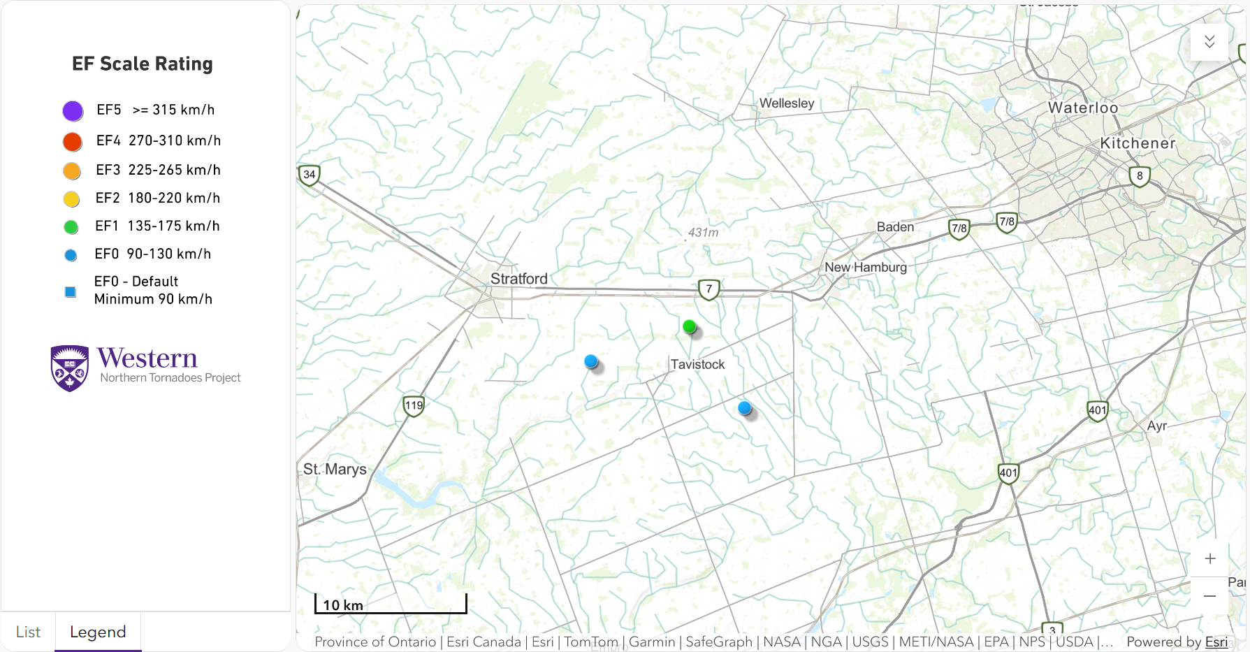
Regional map showing the start locations for the EF1 and EF0 tornadoes and the worst damage location for the EF0 downburst.
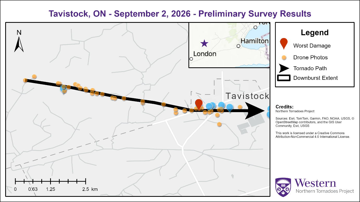
Survey map showing the EF0 tornado tracking from the west into Tavistock.
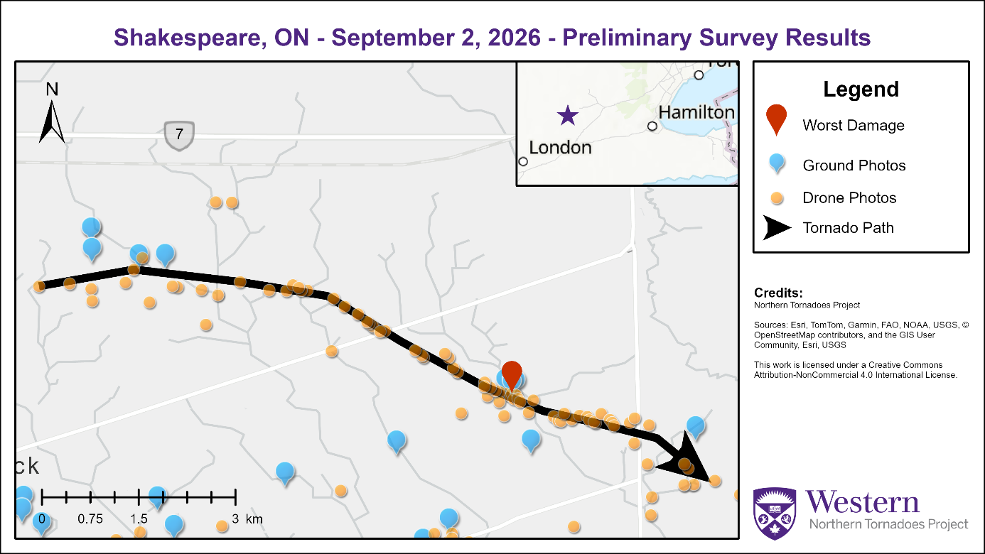
Survey map showing the EF1 tornado starting north of Tavistock and tracking to the southeast.
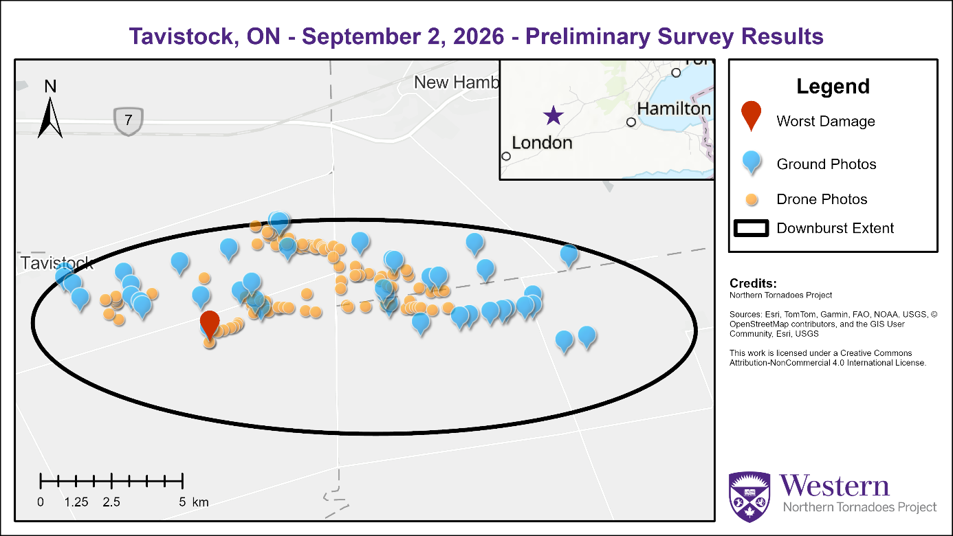
Survey map showing the estimated extent of the downburst occurring mostly to the east-southeast of Tavistock.
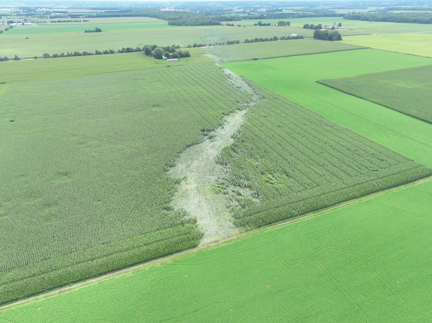
Drone photo of the path of the EF0 tornado clearly seen through crop lodging west of Tavistock, ON.
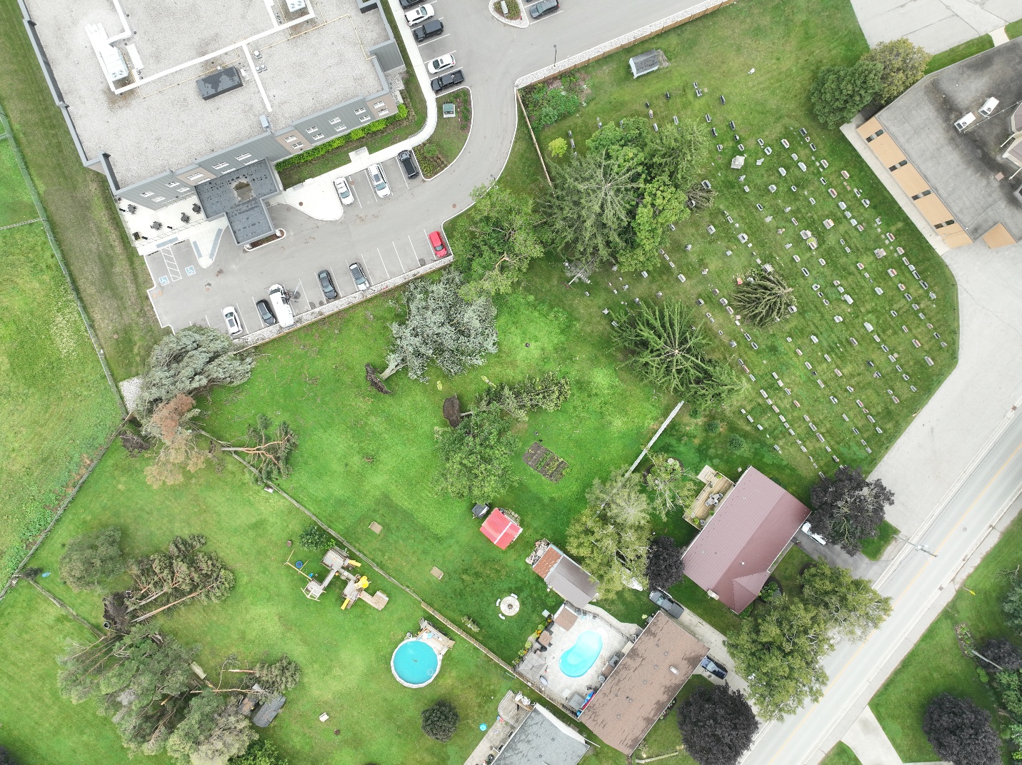
Drone photo showing snapped and uprooted trees near the end of the EF0 track in Tavistock, ON.
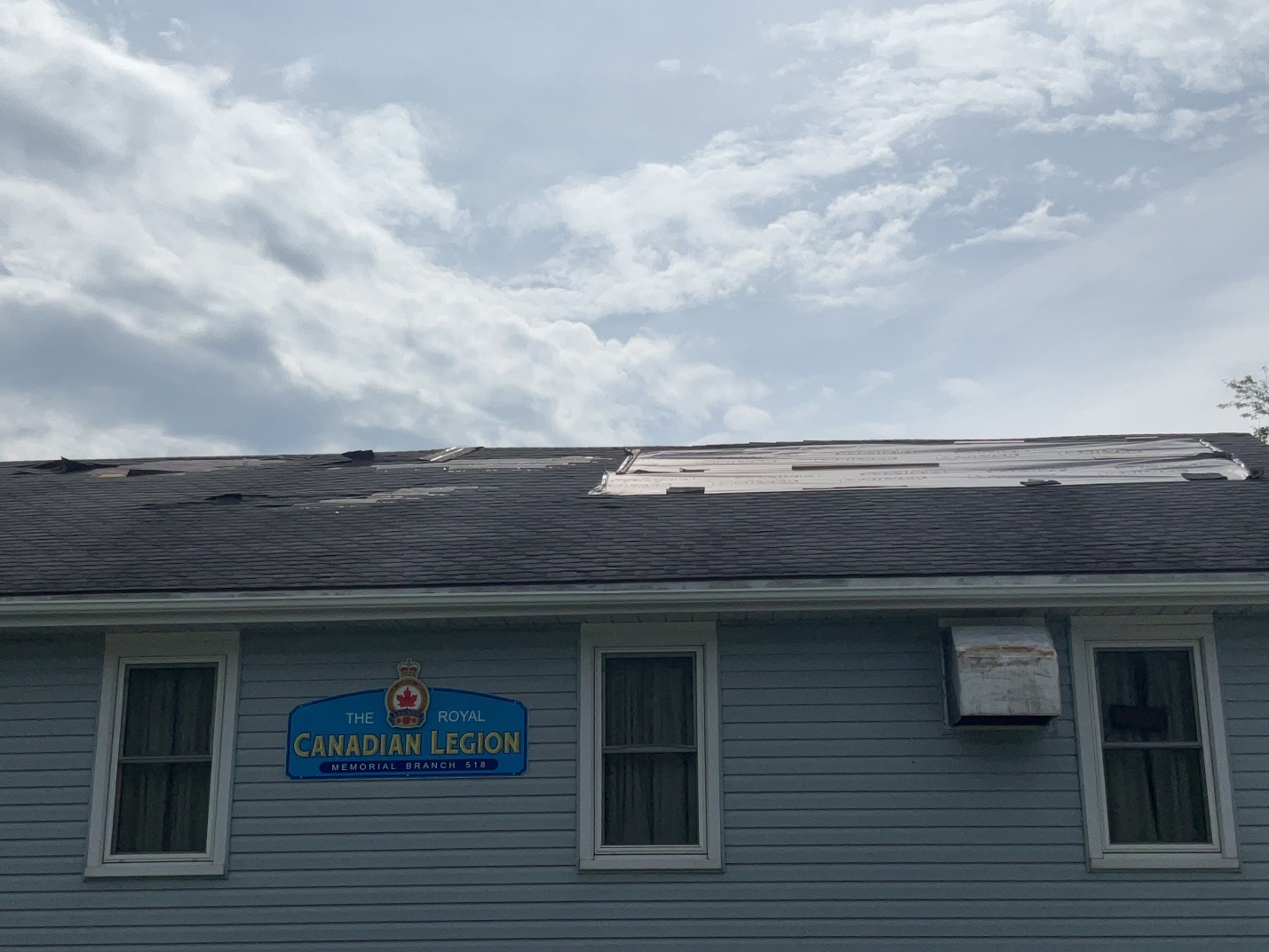
Ground photo showing loss of roof covering at a Legion hall in Tavistock, ON.
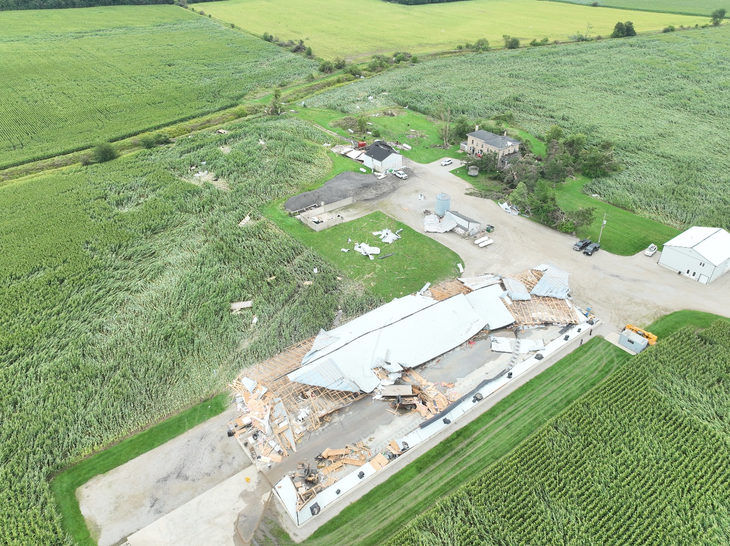
Drone photo of EF1 tornado damage to a barn roof, with tree and crop damage as well.
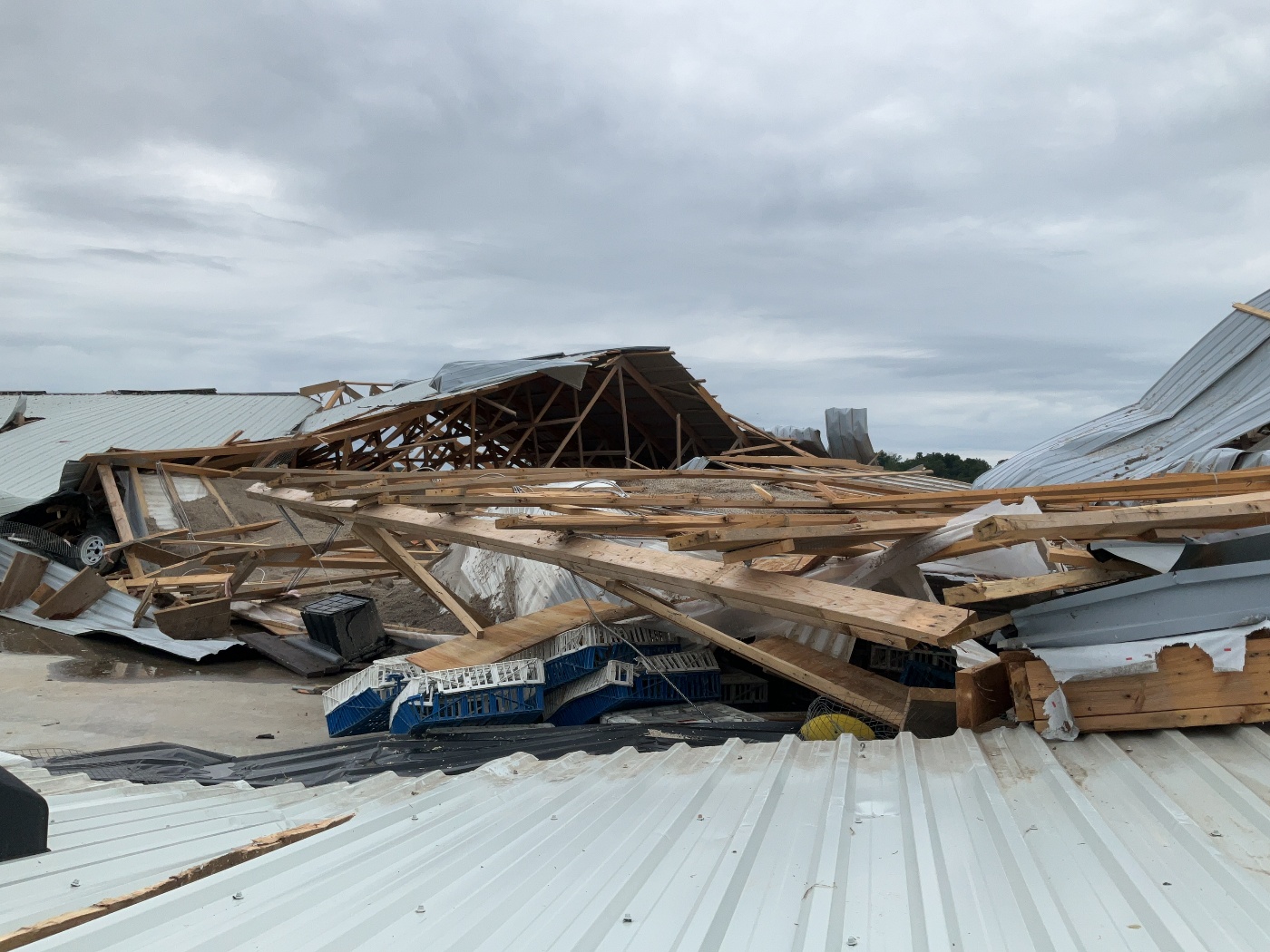
Ground photo of the EF1 tornado damage to the barn.
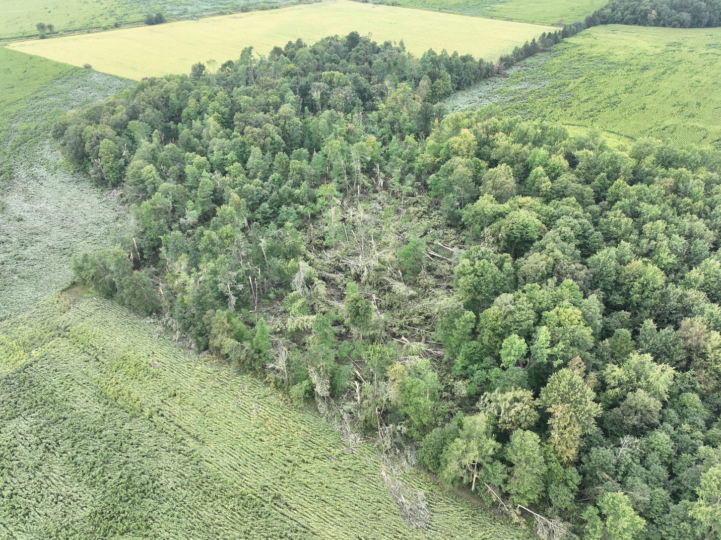
Drone photo of significant tree damage and crop damage caused by the EF1 tornado.
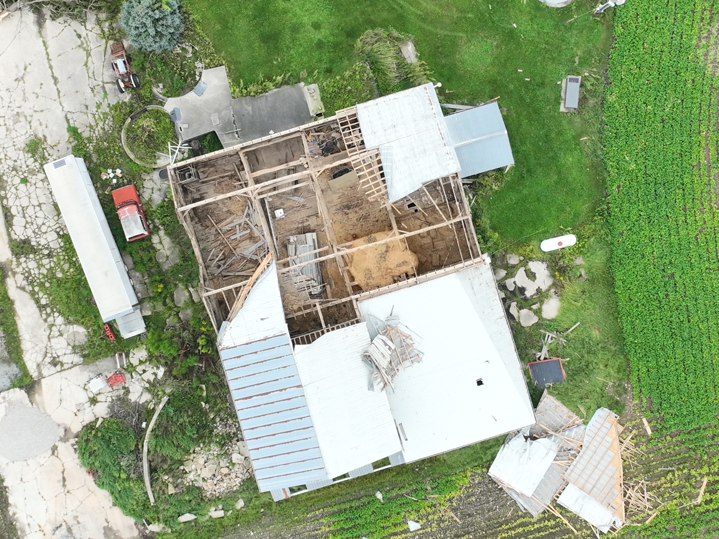
Drone photo of EF0 downburst damage to a barn roof.
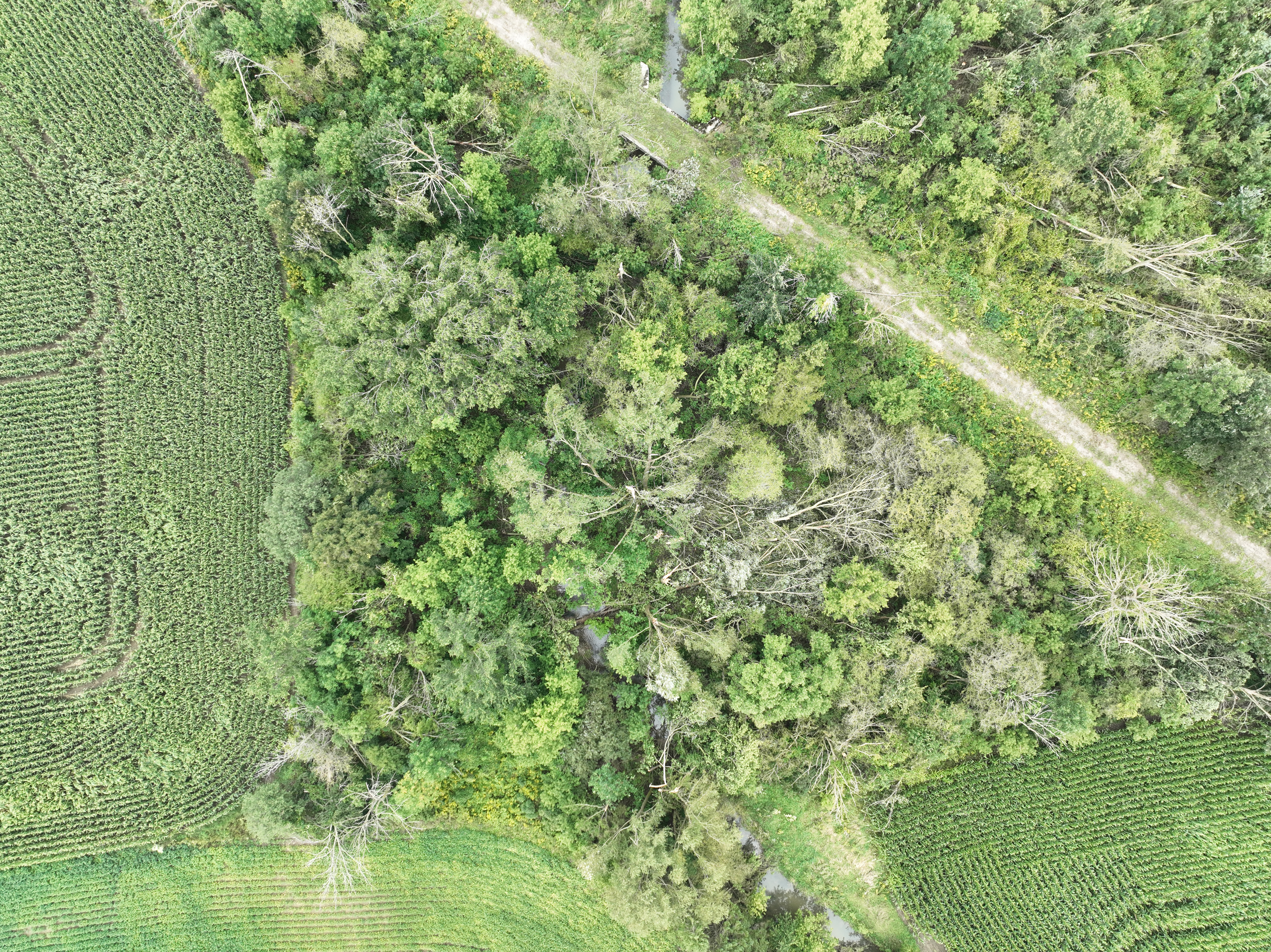
Drone photo of EF0 tree damage along the path of the downburst.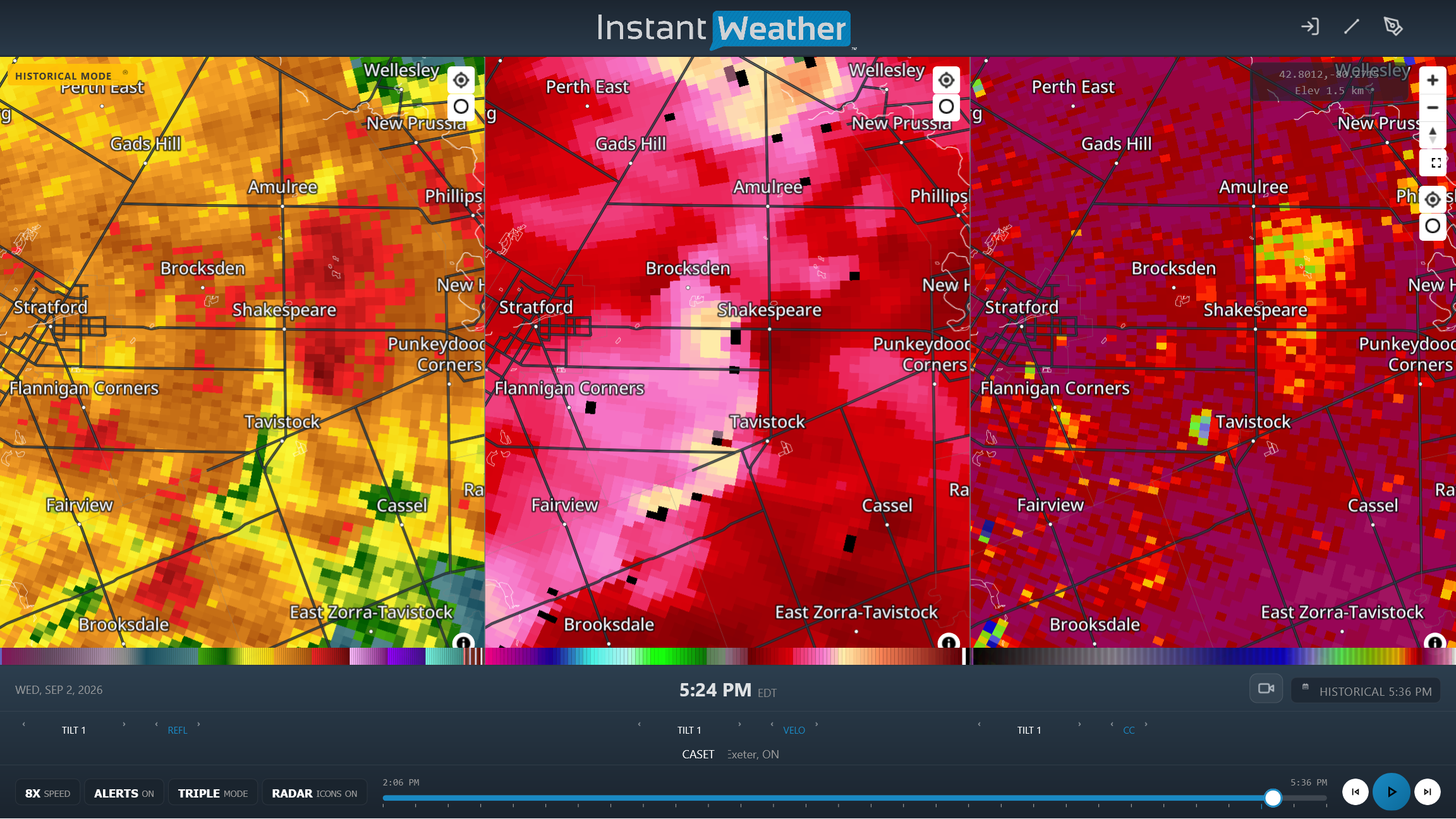
CASET radar image showing reflectivity (left), radial velocity (centre) and correlation coefficient (right) products. The two velocity maxima (yellow) near Shakespeare and Tavistock were where the tornadoes developed. A brief tornado debris signature can be seen with the tornado approaching Tavistock at right (blue pixels).


